Blåisvatnet: the turquoise glacier lake at the foot of the Lyngen Alps
An 8 km return walk over glacial river stones to a lake fed by the Lenangsbreen glacier. The trailhead, the colour science and the timing that makes it work.
Blåisvatnet sits at 189 meters below the Lenangsbreen glacier on the Lyngen peninsula. The 8 to 9 km return walk from Sør-Lenangsbotn is gentle but ends in a boulder field. Here’s why the water turns turquoise, when the light is right and what to wear.
Blåisvatnet sits at 189 meters at the foot of the Lenangsbreen glacier on the Lyngen peninsula. If you've seen photos of the lake, you probably assumed they were colour-graded. They weren't. On a sunny day the water turns a turquoise so saturated that it looks artificial against the grey rock and the snow above it. The colour is glacial geology at work.
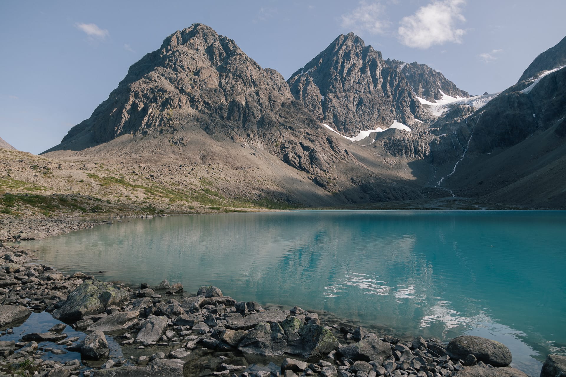
Lenangsbreen grinds the bedrock beneath it into a fine powder called rock flour. Meltwater carries the particles into the lake, where they are fine enough to stay suspended. Sunlight scatters off the particles while the water absorbs the red end of the spectrum, so what reaches your eyes is turquoise. No sun, no colour: under cloud, the lake turns a flat grey-green.
The walk: trailhead to shore
The walk starts from the car park at Sør-Lenangsbotn on the Lyngen peninsula. From Tromsø, drive to Breivikeidet and take the ferry across Ullsfjorden to Svensby, then follow the road north past Jægervatnet to Sør-Lenangsbotn and turn off at the "Lyngsalpan" sign. Allow 1.5 to 2.5 hours from Tromsø, depending on how well you hit the ferry.
The route is 8 to 9 km return with under 200 meters of climbing, and most of it follows a broad glacial river bed. It's a Blue-grade walk by Norwegian standards. The grade comes from the ground, not the gradient: you walk on loose stones most of the way, and the last stretch before the lake is a boulder field with no clear path. Wear boots with ankle support. Trail runners and sneakers are how ankles get twisted here.
Budget 90 minutes to the lake and an hour back, plus your time at the shore.
What works
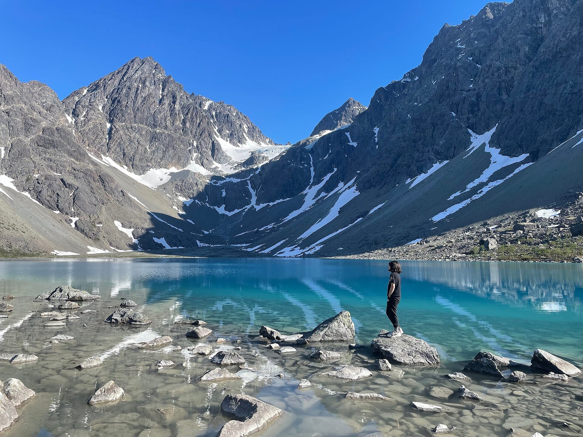
- Sun on the water: The colour needs direct sunlight. Go late morning to early afternoon on a clear day, when the sun clears the ridges around Lenangstinden. Check the cloud forecast on yr.no before you leave Tromsø.
- A windproof layer: Air flowing down off Lenangsbreen is cold even in July. Pack a shell and a warm layer for the time you spend at the shore.
- Water from the side streams: Fill your bottle from fast-flowing streams, not from the lake. The lake water is full of silt.
What doesn't work
- Grey days: Under cloud the lake loses its colour. If the whole peninsula is under cloud, save the walk for a sunny day.
- Walking onto the glacier: Lenangsbreen is a glacier, not a viewpoint, and its crevasses hide under snow. Fjellvettreglene (the Mountain Code) rule 5 applies: on a glacier, travel rope-linked with a guide. Stay at the lake.
- A long swim: Swimming is allowed, but this is glacial meltwater. A quick dip is all most people manage. Don't swim alone.
- Early-season trips: Snow can lie on the route into June. The usual hiking season runs from June to October.
Logistics and parking
| Detail | Information |
|---|---|
| Trailhead | Sør-Lenangsbotn car park, signposted "Lyngsalpan" from the main road |
| Distance | 8 to 9 km return |
| Climb | Under 200 m; the lake sits at 189 m |
| Time | 90 minutes to the lake, 1 hour back |
| Parking | Paid in the Easypark or Parkly app. The fee funds hiking infrastructure in Lyngen municipality |
| From Tromsø | Drive to Breivikeidet, ferry across Ullsfjorden to Svensby, then north past Jægervatnet. 1.5 to 2.5 hours |
| Facilities | Toilet at the car park; nothing at the lake |
Marte Åsheim is the Mountain Safety Editor at NorgeTravel. She has spent 18 years guiding in Jotunheimen and Rondane, based in Lom. She has zero tolerance for hikers who treat a glacier as a viewpoint. She can be reached at hei@norgetravel.com.
Sources: Visit Lyngenfjord (Blåisvatnet hike page); UT.no route data. Checked October 2026.
Plan your Norway itinerary
Use our free, interactive trip planner to map out your route through Norway, book verified eco-friendly cabins and transport, and sync with local ferry timetables.
Up Next: Keep Exploring
RIB Fjordsafari Geirangerfjord: what the cruise ship cannot show you
The RIB Fjordsafari puts you 15 meters from the Seven Sisters waterfall at 35 knots. Here is exactly what works, what does not, and whether the 895 NOK price tag is justified.
Kayaking beneath the Seven Sisters: 4 hours on Geirangerfjord at paddle height
The Geiranger kayak tour puts 8 paddlers beneath the Seven Sisters waterfall at arm's reach from the cliff wall. 4 hours, 1,550 NOK, drysuits provided. Here is exactly what the experience delivers and who should book it.
Geiranger by car: Eagle Road, Flydalsjuvet, and Dalsnibba in one drive
The Eagle Road climbs 620 meters in 11 hairpin bends. Dalsnibba sits at 1,476 meters with the fjord as a thin blue line below. Here is how to drive both in a single day without fighting the tour buses for parking.