Husfjellet: the plateau peak above Skaland, Senja
A DNT Blue hike to a 635-metre plateau summit above Skaland with open views across to Okshornan. No scrambling. Boardwalks on the lower section.
Husfjellet is the family-friendly Senja peak. 635 metres, 5 km round trip, 3 to 4 hours, DNT Blue on a good path with boardwalks across the bogs. Open plateau summit looking directly at the Okshornan ridge. No scrambling.
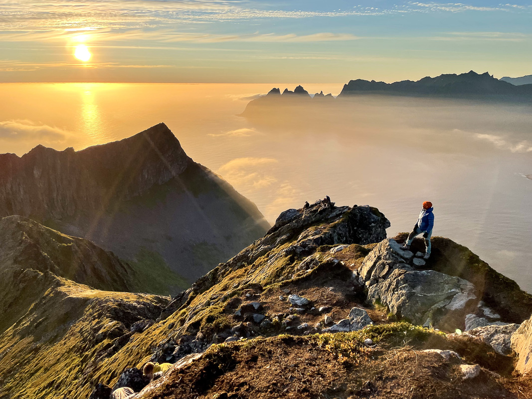
Husfjellet is the Senja hike to do when Segla is rained off or the Fjordgård car park is full. It is DNT Blue, it is boardwalked across the boggy lower section, and the summit is a broad plateau rather than a ridge scramble. The view from the top looks straight across the Bergsfjord at the Okshornan range, which is the other silhouette everyone photographs on Senja.
This is the right peak for a mixed-ability group and for a cloudy day with a forecast that does not justify Segla.
The honest grade
DNT Blue. No scrambling. No exposure. Steady climb on a marked path for the first two-thirds, then open plateau for the last push. The boardwalks mean the bog at 200 to 350 metres does not ruin your boots.
This does not mean the weather is friendly. The plateau is fully exposed. If the wind is 15 m/s at sea level it will be 25 on top. The summit does not offer shelter.
The route
Trailhead. Skaland, on the northwest coast of Senja. Park at the signed car park off the old mine road above the village. Roughly 30 cars, fee in summer.
Lower section. Birch forest and open slope on a marked T-path. Boardwalks across the wet section between 200 and 350 metres. 45 to 60 minutes.
Upper section. Open tundra climbing to the plateau edge. Cairns mark the route. 45 minutes to the plateau rim.
Summit plateau. The true summit is a 10-minute walk across the plateau from where the path crests the rim. Do walk to the actual cairn — the Okshornan view is better from there.
Descent. Same route. 1.5 to 2 hours.
Gear
- Waterproof boots. The boardwalks help but not all of it is boarded.
- Windproof layer, always.
- Map: Turkart Senja 1:50,000.
- Water. 1 to 1.5 litres.
Fjellvettreglene applied
Rule 2: adapt the trip to the conditions. Husfjellet is often the correct choice when Segla is forecast wet. Rule 3: read the weather — wind on the plateau is the real variable.
Logistics
| Item | Detail |
|---|---|
| Trailhead | Skaland, old mine road car park |
| Parking | ~30 cars, fee |
| Season | Mid-June to mid-October |
| Nearest fuel | Silsand or Gryllefjord |
| Emergency | 112. Nearest A&E: Tromsø (UNN) |
Who should do Husfjellet
Families with teenagers, mixed-ability groups, anyone who wants a real Senja peak without the Segla scramble, and photographers who want the Okshornan shot from across the fjord.
Who should skip it
Anyone already comfortable with exposure who specifically came for Segla. Do Segla first, then Husfjellet as a rest-day option.
Plan your Norway itinerary
Use our free, interactive trip planner to map out your route through Norway, book verified eco-friendly cabins and transport, and sync with local ferry timetables.
Up Next: Keep Exploring
RIB Fjordsafari Geirangerfjord: what the cruise ship cannot show you
The RIB Fjordsafari puts you 15 meters from the Seven Sisters waterfall at 35 knots. Here is exactly what works, what does not, and whether the 895 NOK price tag is justified.
Kayaking beneath the Seven Sisters: 4 hours on Geirangerfjord at paddle height
The Geiranger kayak tour puts 8 paddlers beneath the Seven Sisters waterfall at arm's reach from the cliff wall. 4 hours, 1,550 NOK, drysuits provided. Here is exactly what the experience delivers and who should book it.
Geiranger by car: Eagle Road, Flydalsjuvet, and Dalsnibba in one drive
The Eagle Road climbs 620 meters in 11 hairpin bends. Dalsnibba sits at 1,476 meters with the fjord as a thin blue line below. Here is how to drive both in a single day without fighting the tour buses for parking.