Ryten and Kvalvika: the 543-metre ledge above Lofoten's beach
The second-most-photographed peak in Lofoten, from Moskenesøya's outer coast. Two trailheads, one summit, and the cliff-edge viewpoint that the internet calls a mini-Trolltunga.
Ryten rises 543 metres directly above Kvalvika Beach on Moskenesøya. A DNT Blue trail, 7 kilometres out-and-back, 520 metres of elevation gain, 3 to 5 hours. Two separate trailheads serve the peak. The cliff-edge selfie is optional. The hike itself is the reward.
Ryten gets called a mini-Trolltunga on the internet, which is misleading in both directions. Ryten is shorter, wetter, and on an exposed coast. It is also quieter. On any given summer day, the actual Trolltunga above Ringedalsvatnet has 800 people queueing for the ledge. Ryten has perhaps 80. That ratio is the reason to hike it.
The peak sits at 543 metres above Kvalvika Beach on the western coast of Moskenesøya, 40 minutes drive from Reine. The classic route is 7 kilometres out-and-back from Innersand, with 520 metres of elevation gain. A shorter alternative from Torsfjorden reaches Kvalvika Beach in 2 kilometres and Ryten summit in another 2.5. Both routes are DNT Blue. Both route-finding is straightforward in summer. Both turn into a different kind of hike in wind, mist, or after rain.
The honest grade
Ryten is DNT Blue: medium difficulty, elevation gain under 600 metres, distance under 10 km. The Innersand route gains 520 metres over 3.5 km ascending. Gradient averages 15 per cent with steeper sections near the summit ridge. No scrambling, no chains, no technical terrain.
What the Blue grade hides: the surface. Much of the lower Innersand route crosses boggy ground that stays wet through July. The upper ridge is exposed rock and short grass. Both surfaces are genuinely slippery when wet. Waterproof boots matter here more than on most Lofoten routes.
The Torsfjorden alternative is shorter and drops to Kvalvika Beach first before climbing to Ryten. It is the route to take if you want to see the beach close up. It adds elevation to your total day: you descend 180 metres to the beach and then climb 520 metres to the summit, for a cumulative gain of around 700 metres.
The two trailheads
Innersand (also written Indresand). The most common starting point. Paid parking at the farm, roughly 80 spaces. 100 NOK per vehicle, paid at the machine. The parking is monitored in summer. Cars left unpaid get ticketed. From the parking the trail climbs steadily across bog and heath to a bench at the ridge, then along the plateau to the summit. 3.5 km each way.
Torsfjorden (Kvalvika parking). 16 paid spaces at the end of a gravel road off the main road near Fredvang. 100 NOK. Because the lot is small, it fills before 09:00 in July and August. Overflow parking is not permitted along the gravel access road. If the lot is full, drive to Innersand and take the longer route. The Torsfjorden trail descends steeply to Kvalvika Beach (2 km, 180m drop), then climbs the southern flank of Ryten (2.5 km, 520m gain) to the summit.
Most visitors take the Innersand route for the summit and skip the beach descent. Most visitors with two days do the Innersand summit one day and the Torsfjorden beach walk another. The two routes give different experiences.
The cliff-edge viewpoint
The photograph that draws most people here is taken from a cliff promontory 50 metres west of the true summit. The flat grass-topped rock projects out over the 500-metre drop to Kvalvika Beach. There is no guardrail. There is no official path to the edge. The ground is grass on thin soil over granite.
The view from the promontory is the one Lofoten postcards use. The view from the true summit (another 50 metres of walking) is roughly equivalent and does not require standing on a wet cliff edge in wind. If you want the photograph, wait for dry conditions, stay well back from the edge, and do not approach if the wind is above 10 m/s. People have died on similar viewpoints across Norway. The Ryten promontory has not seen a fatality yet. That statistic will not hold forever.
The turn-back rule
- Mist on the plateau. The Ryten plateau fogs up fast when warm air meets the coast. Once visibility drops below 50 metres, navigating between the summit, the cliff edge, and the descent route becomes a compass-and-map problem. Turn back at the ridge bench if the mist is rolling in.
- Wind above 12 m/s at the summit. The cliff edge is untenable. The true summit is exposed but manageable at lower wind. Above 12, descend and hike Festvågtind or another inland route instead.
- Heavy rain in the previous 12 hours. The lower bog becomes a waterlogged slog. Possible, but miserable, and the upper grass ridge gets slick. Waterproof boots help. A dry day is better.
Gear for this route
- Waterproof hiking boots with ankle support. Bog crossings are constant on the Innersand route.
- Wind shell jacket. The plateau has no shelter.
- Light down or fleece for summit stops.
- 2 litres of water. No reliable water source on route.
- Packed lunch. The summit plateau is worth an extended stop in good weather.
- Camera with a wide lens (for the Kvalvika Beach framing, not the cliff-edge selfie).
- Map and compass. The plateau route can be obscured in mist.
Fjellvettreglene on this route
The Norwegian Mountain Code matters on every hike. On Ryten, four rules are directly load-bearing:
- Rule 2: Adapt the trip to ability and conditions. Bog conditions on the Innersand route are harder than the DNT grade suggests in wet years. Rethink boots and timing after heavy rain.
- Rule 3: Pay attention to weather and avalanche forecasts. Coastal Lofoten weather turns fast. Check yr.no for Flakstad municipality within 24 hours of your hike.
- Rule 7: Use a map and compass. The plateau is featureless in mist. GPS on a phone works when the battery and the signal both hold. A physical map does not rely on either.
- Rule 8: Turn back in time. The cliff-edge viewpoint is not worth dying for. Neither is the summit.
The logistics
| Detail | Information |
|---|---|
| Summit elevation | 543 m |
| Distance (Innersand) | 7 km out-and-back |
| Elevation gain (Innersand) | 520 m |
| Distance (Torsfjorden to beach) | 4 km out-and-back, 180 m descent to beach |
| Time | 3 to 5 hours (summit only). Add 2 hours for the beach loop. |
| DNT grade | Blue (medium) |
| Season | Mid-June through September |
| Parking (Innersand) | 100 NOK, roughly 80 spaces |
| Parking (Torsfjorden) | 100 NOK, 16 spaces only. Fills by 09:00 in peak season. |
| Innersand GPS | 68.1040°N, 13.1710°E |
| Location | Moskenesøya, near Fredvang on the E10 |
| Emergency | 112 (police/rescue), 113 (medical) |
Who should hike this
- Travellers with a full day on Moskenesøya. Ryten fills 5 to 7 hours door-to-door from Reine. It is the best half-day hike on the outer coast.
- Anyone avoiding the Reinebringen queue. Same quality of view, roughly one-tenth of the foot traffic.
- Hikers with two full days. Ryten on day one, Kvalvika Beach approach from Torsfjorden on day two. Different routes, different experience.
Who should skip this
- Visitors with one half-day in Lofoten. Reinebringen is shorter if you are rushing. Ryten rewards time.
- Hikers in rain or mist. The bog-heavy Innersand route is a miserable experience wet. The plateau route-finding gets harder in fog.
- Anyone expecting a solo cliff-edge photo. On a summer afternoon, you will queue for the ledge. The true summit is the better destination.
Marte Åsheim is the Mountain Safety Editor at NorgeTravel. DNT-certified guide with 18 years of experience across Jotunheimen, Rondane, and the Nordic peaks. She writes trail guides so that you come home afterward. She can be reached at hei@norgetravel.com.
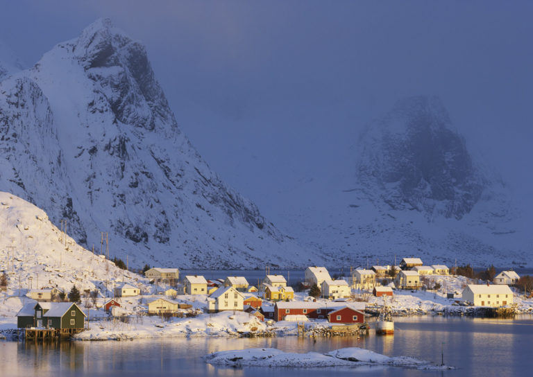
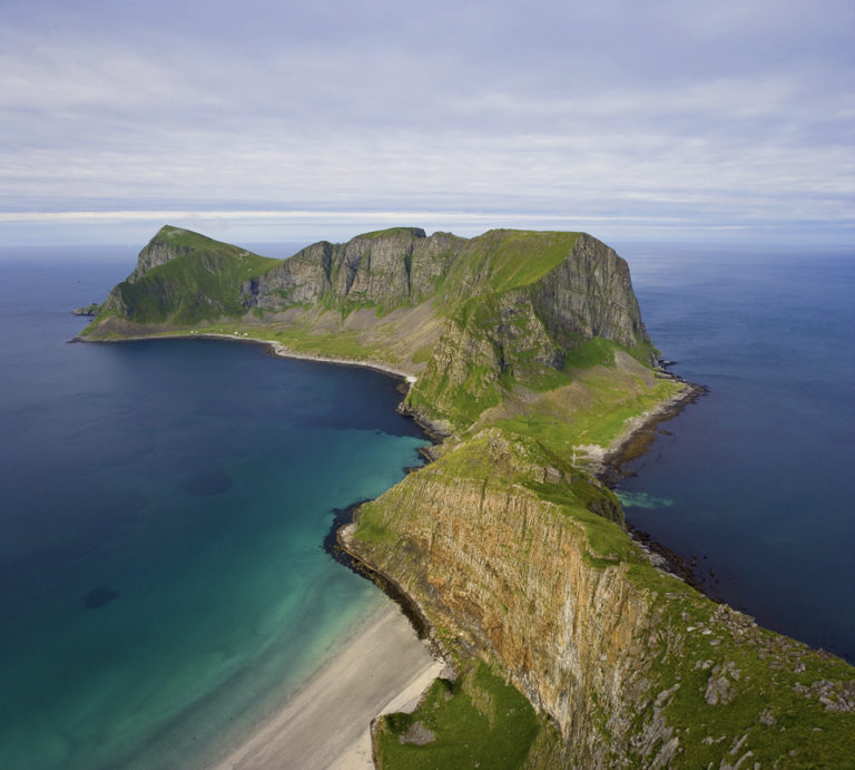
Image: Lofoten coast by Baard Loeken, provided by Visit Northern Norway.
Plan your Norway itinerary
Use our free, interactive trip planner to map out your route through Norway, book verified eco-friendly cabins and transport, and sync with local ferry timetables.
Up Next: Keep Exploring
RIB Fjordsafari Geirangerfjord: what the cruise ship cannot show you
The RIB Fjordsafari puts you 15 meters from the Seven Sisters waterfall at 35 knots. Here is exactly what works, what does not, and whether the 895 NOK price tag is justified.
Kayaking beneath the Seven Sisters: 4 hours on Geirangerfjord at paddle height
The Geiranger kayak tour puts 8 paddlers beneath the Seven Sisters waterfall at arm's reach from the cliff wall. 4 hours, 1,550 NOK, drysuits provided. Here is exactly what the experience delivers and who should book it.
Geiranger by car: Eagle Road, Flydalsjuvet, and Dalsnibba in one drive
The Eagle Road climbs 620 meters in 11 hairpin bends. Dalsnibba sits at 1,476 meters with the fjord as a thin blue line below. Here is how to drive both in a single day without fighting the tour buses for parking.