Blåisvatnet: the turquoise glacier lake at the foot of the Lyngen Alps
An 8 km return walk over glacial river stones to a lake fed by the Lenangsbreen glacier. The trailhead, the colour science and the timing that makes it work.
Blåisvatnet sits at 189 meters below the Lenangsbreen glacier on the Lyngen peninsula. The 8 to 9 km return walk from Sør-Lenangsbotn is gentle but ends in a boulder field. Here’s why the water turns turquoise, when the light is right and what to wear.
Blåisvatnet sits at 189 meters at the foot of the Lenangsbreen glacier on the Lyngen peninsula. If you've seen photos of the lake, you probably assumed they were colour-graded. They weren't. On a sunny day the water turns a turquoise so saturated that it looks artificial against the grey rock and the snow above it. The colour is glacial geology at work.
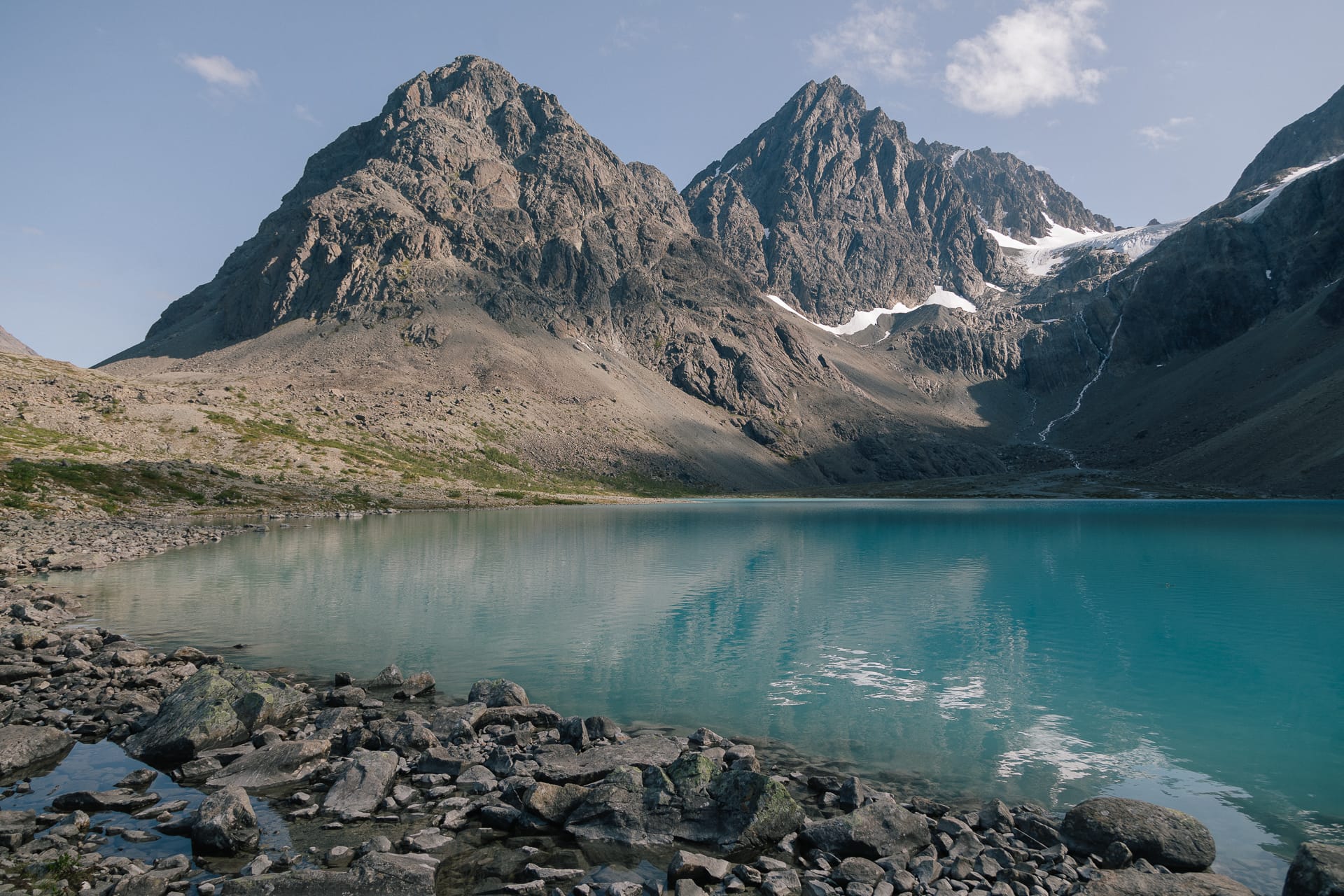
Lenangsbreen grinds the bedrock beneath it into a fine powder called rock flour. Meltwater carries the particles into the lake, where they are fine enough to stay suspended. Sunlight scatters off the particles while the water absorbs the red end of the spectrum, so what reaches your eyes is turquoise. No sun, no colour: under cloud, the lake turns a flat grey-green.
The walk: trailhead to shore
The walk starts from the car park at Sør-Lenangsbotn on the Lyngen peninsula. From Tromsø, drive to Breivikeidet and take the ferry across Ullsfjorden to Svensby, then follow the road north past Jægervatnet to Sør-Lenangsbotn and turn off at the "Lyngsalpan" sign. Allow 1.5 to 2.5 hours from Tromsø, depending on how well you hit the ferry.
The route is 8 to 9 km return with under 200 meters of climbing, and most of it follows a broad glacial river bed. It's a Blue-grade walk by Norwegian standards. The grade comes from the ground, not the gradient: you walk on loose stones most of the way, and the last stretch before the lake is a boulder field with no clear path. Wear boots with ankle support. Trail runners and sneakers are how ankles get twisted here.
Budget 90 minutes to the lake and an hour back, plus your time at the shore.
What works
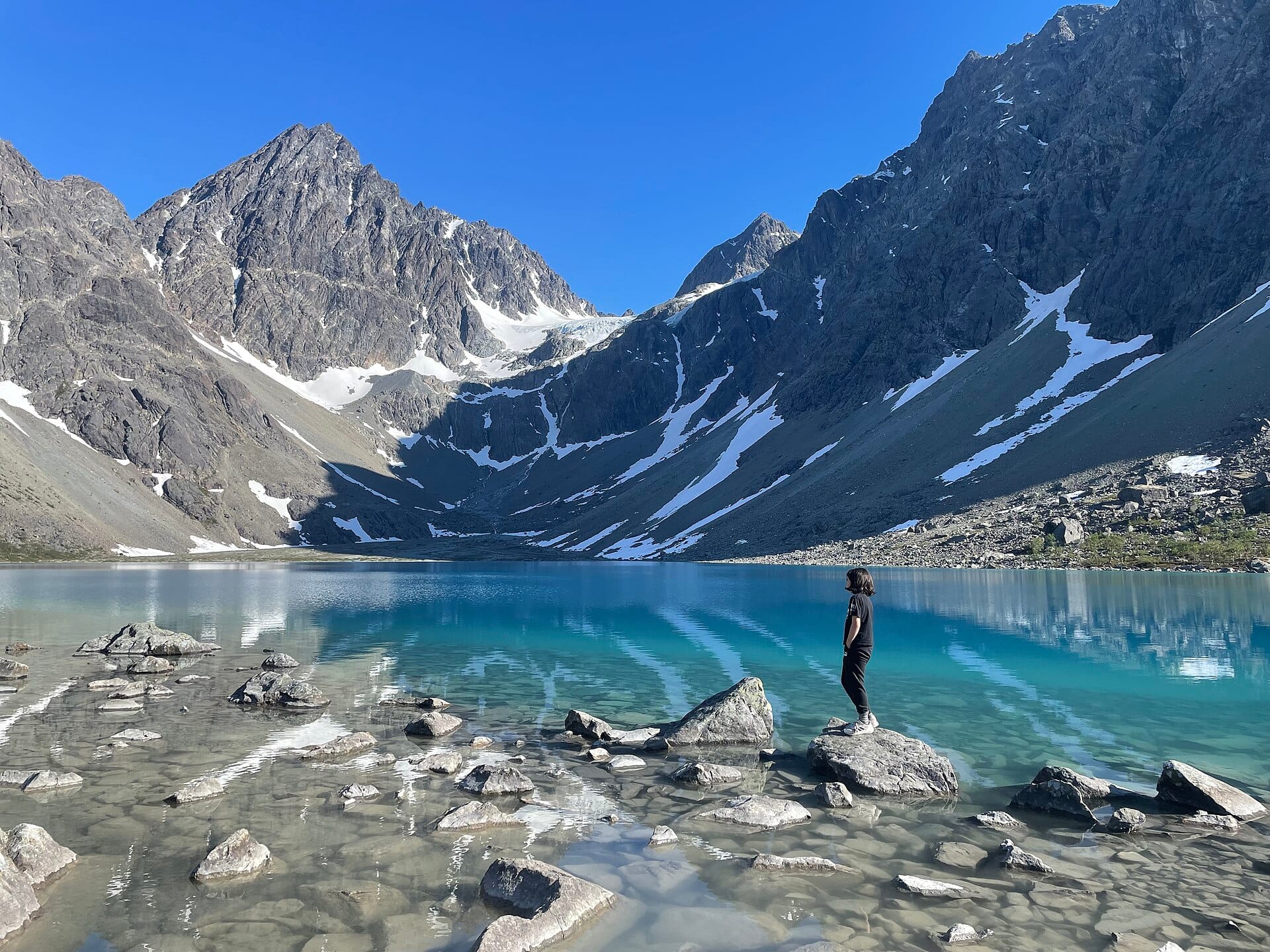
- Sun on the water: The colour needs direct sunlight. Go late morning to early afternoon on a clear day, when the sun clears the ridges around Lenangstinden. Check the cloud forecast on yr.no before you leave Tromsø.
- A windproof layer: Air flowing down off Lenangsbreen is cold even in July. Pack a shell and a warm layer for the time you spend at the shore.
- Water from the side streams: Fill your bottle from fast-flowing streams, not from the lake. The lake water is full of silt.
What doesn't work
- Grey days: Under cloud the lake loses its colour. If the whole peninsula is under cloud, save the walk for a sunny day.
- Walking onto the glacier: Lenangsbreen is a glacier, not a viewpoint, and its crevasses hide under snow. Fjellvettreglene (the Mountain Code) rule 5 applies: on a glacier, travel rope-linked with a guide. Stay at the lake.
- A long swim: Swimming is allowed, but this is glacial meltwater. A quick dip is all most people manage. Don't swim alone.
- Early-season trips: Snow can lie on the route into June. The usual hiking season runs from June to October.
Logistics and parking
| Detail | Information |
|---|---|
| Trailhead | Sør-Lenangsbotn car park, signposted "Lyngsalpan" from the main road |
| Distance | 8 to 9 km return |
| Climb | Under 200 m; the lake sits at 189 m |
| Time | 90 minutes to the lake, 1 hour back |
| Parking | Paid in the Easypark or Parkly app. The fee funds hiking infrastructure in Lyngen municipality |
| From Tromsø | Drive to Breivikeidet, ferry across Ullsfjorden to Svensby, then north past Jægervatnet. 1.5 to 2.5 hours |
| Facilities | Toilet at the car park; nothing at the lake |
Marte Åsheim is the Mountain Safety Editor at NorgeTravel. She has spent 18 years guiding in Jotunheimen and Rondane, based in Lom. She has zero tolerance for hikers who treat a glacier as a viewpoint. She can be reached at hei@norgetravel.com.
Sources: Visit Lyngenfjord (Blåisvatnet hike page); UT.no route data. Checked October 2026.
ノルウェー旅行のプランを立てる
無料のインタラクティブなトリッププランナーで、ノルウェーのルートを計画し、認証済みのエコフレンドリーな宿泊と交通を予約し、現地のフェリー時刻表を確認できます。
Up Next: Keep Exploring
RIBフィヨルドサファリ ゲーランゲルフィヨルド:クルーズ船では味わえない体験
RIBフィヨルドサファリなら、セブンシスターズの滝からわずか15メートルの距離まで時速35ノットで大接近。このツアーの魅力、惜しい点、そして895ノルウェークローネという料金が本当に妥当なのかを正直にレビューします。
セブンシスターズの滝の下でカヤック体験:ガイランゲルフィヨルドをパドルで4時間
ガイランゲルでのカヤックツアーでは、8名のパドラーがセブンシスターズの滝のすぐ下、切り立った崖の壁に手が届くほどの距離に。4時間、1,550ノルウェークローネ、ドライスーツ貸与。この体験で得られるものと、どんな人におすすめなのかを詳しくご紹介します。
車で巡るガイランゲル:鷲の道、フライダルスユーヴェ、ダルスニッバを一日で満喫
鷲の道は11のヘアピンカーブで620メートルの高さを駆け上がり、ダルスニッバ(標高1,476メートル)からはフィヨルドが細い青い線となって眼下に広がります。ツアーバスと駐車スペースを奪い合うことなく、これらすべてを一日でドライブする方法をご紹介します。