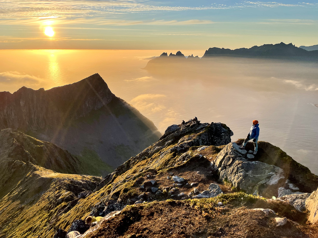
フースフィェレ山:シェーラン村上空に広がるセンヤ島の高原の頂
DNTブルー指定のハイキングコース。シェーラン村上空635メートルの高原の頂上まで続き、オクショルナンを望む絶景が広がります。岩場でのよじ登りはありません。下のセクションには木道があります。
フースフィェレ山は、センヤ島で家族連れに優しい山です。標高635メートル、往復5km、所要時間は3~4時間。DNTブルー指定の良好な道を、湿地帯に架かる木道を歩いて進みます。開けた高原の頂上からは、オクショルナン山稜が目の前に見えます。岩場でのよじ登りはありません。
Husfjellet is the Senja hike to do when Segla is rained off or the Fjordgård car park is full. It is DNT Blue, it is boardwalked across the boggy lower section, and the summit is a broad plateau rather than a ridge scramble. The view from the top looks straight across the Bergsfjord at the Okshornan range, which is the other silhouette everyone photographs on Senja.
This is the right peak for a mixed-ability group and for a cloudy day with a forecast that does not justify Segla.
The honest grade
DNT Blue. No scrambling. No exposure. Steady climb on a marked path for the first two-thirds, then open plateau for the last push. The boardwalks mean the bog at 200 to 350 metres does not ruin your boots.
This does not mean the weather is friendly. The plateau is fully exposed. If the wind is 15 m/s at sea level it will be 25 on top. The summit does not offer shelter.
The route
Trailhead. Skaland, on the northwest coast of Senja. Park at the signed car park off the old mine road above the village. Roughly 30 cars, fee in summer.
Lower section. Birch forest and open slope on a marked T-path. Boardwalks across the wet section between 200 and 350 metres. 45 to 60 minutes.
Upper section. Open tundra climbing to the plateau edge. Cairns mark the route. 45 minutes to the plateau rim.
Summit plateau. The true summit is a 10-minute walk across the plateau from where the path crests the rim. Do walk to the actual cairn — the Okshornan view is better from there.
Descent. Same route. 1.5 to 2 hours.
Gear
- Waterproof boots. The boardwalks help but not all of it is boarded.
- Windproof layer, always.
- Map: Turkart Senja 1:50,000.
- Water. 1 to 1.5 litres.
Fjellvettreglene applied
Rule 2: adapt the trip to the conditions. Husfjellet is often the correct choice when Segla is forecast wet. Rule 3: read the weather — wind on the plateau is the real variable.
Logistics
| Item | Detail |
|---|---|
| Trailhead | Skaland, old mine road car park |
| Parking | ~30 cars, fee |
| Season | Mid-June to mid-October |
| Nearest fuel | Silsand or Gryllefjord |
| Emergency | 112. Nearest A&E: Tromsø (UNN) |
Who should do Husfjellet
Families with teenagers, mixed-ability groups, anyone who wants a real Senja peak without the Segla scramble, and photographers who want the Okshornan shot from across the fjord.
Who should skip it
Anyone already comfortable with exposure who specifically came for Segla. Do Segla first, then Husfjellet as a rest-day option.
ノルウェー旅行のプランを立てる
無料のインタラクティブなトリッププランナーで、ノルウェーのルートを計画し、認証済みのエコフレンドリーな宿泊と交通を予約し、現地のフェリー時刻表を確認できます。
Up Next: Keep Exploring
RIBフィヨルドサファリ ゲーランゲルフィヨルド:クルーズ船では味わえない体験
RIBフィヨルドサファリなら、セブンシスターズの滝からわずか15メートルの距離まで時速35ノットで大接近。このツアーの魅力、惜しい点、そして895ノルウェークローネという料金が本当に妥当なのかを正直にレビューします。
セブンシスターズの滝の下でカヤック体験:ガイランゲルフィヨルドをパドルで4時間
ガイランゲルでのカヤックツアーでは、8名のパドラーがセブンシスターズの滝のすぐ下、切り立った崖の壁に手が届くほどの距離に。4時間、1,550ノルウェークローネ、ドライスーツ貸与。この体験で得られるものと、どんな人におすすめなのかを詳しくご紹介します。
車で巡るガイランゲル:鷲の道、フライダルスユーヴェ、ダルスニッバを一日で満喫
鷲の道は11のヘアピンカーブで620メートルの高さを駆け上がり、ダルスニッバ(標高1,476メートル)からはフィヨルドが細い青い線となって眼下に広がります。ツアーバスと駐車スペースを奪い合うことなく、これらすべてを一日でドライブする方法をご紹介します。