ルースタ:ガイランゲルフィヨルド上空500m、努力の末に辿り着く絶景
足場も手すりもなく、人混みとは無縁の場所。ロープセクションを越えれば、ガイランゲルフィヨルドを独り占めできる唯一の展望台です。
ルースタは、ガイランゲルフィヨルド上空500mに突き出す天然の岩の展望台です。ベステラス農場から1.5km、標高差210m、1ヶ所のロープセクションを越えると、フィヨルド、イーグルロード、眼下の村々が織りなす120度のパノラマが広がります。遮るものも人混みもありません。
There are four viewpoints above Geirangerfjord that you can drive to. Flydalsjuvet has the postcard angle. Ørnesvingen has the Eagle Road below you. Dalsnibba has the glacier panorama at 1,476 meters. All three involve a car, a parking fee, and a crowd. Løsta is the viewpoint you earn on foot: 500 meters above the fjord, natural rock, no platform, no railing, no one selling waffles at the top. On a clear morning, you can see the Eagle Road hairpins, the village, the cruise ships, and Homlong across the water. The view is not filtered through a safety barrier. It is filtered through the sweat it took to get there.
The trail starts from Vesteras Gard farm, the same 17th-century seter (summer mountain farm) that serves as the trailhead for Storseterfossen. From Vesteras, it is roughly 1.5 km to the viewpoint with 210 meters of elevation gain. The first half follows a wide tractor road through grazing pastures. The second half narrows into a mountain path with one rope-assisted section over steep rock. There is no official DNT grade for Løsta, but the terrain places it between Blue and Red on the Norwegian scale: moderate fitness required, proper footwear essential, and the rope section demands honest self-assessment.
What this trail actually is
Løsta is an ancient abandoned settlement turned viewpoint, accessed by a trail that changes character halfway through. The hike splits into two distinct sections.
Section 1: Vesteras to the trail split (600–700 meters). A wide tractor road through birch forest and grazing pastures. You pass through a gate at the farm. Close it behind you. Sheep, goats, and llamas roam the path. Expect manure. The walking is flat to gentle uphill, and anyone in reasonable health can manage it.
Section 2: Trail split to Løsta viewpoint (800–900 meters). Turn right at the fork (left goes to Vesteråsfjellet, a shorter and easier viewpoint). The path narrows into a mountain trail: exposed roots, large rocks, mud even in dry weather, and one rope-assisted section where the terrain steepens over slick rock. This is where the hike earns its difficulty. The final approach to the viewpoint is open and exposed.
The viewpoint
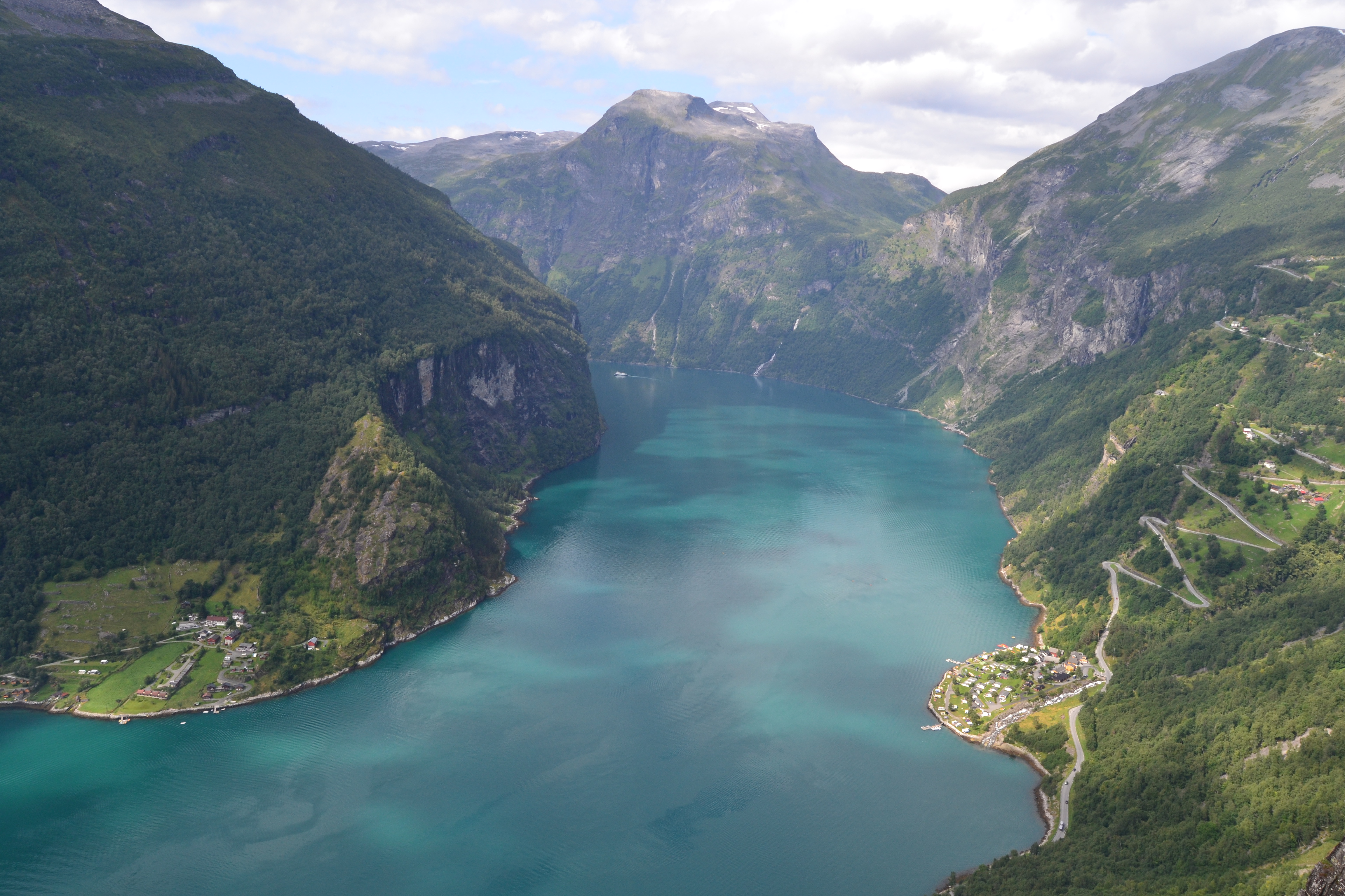
Løsta is a natural rock promontory at approximately 500 meters above sea level. There is no built platform. There are no fences or safety barriers. You stand on exposed rock with a 120-degree panorama of the Geirangerfjord.
What you see: the full length of the fjord stretching westward, the Eagle Road (Ørnevegen) switchbacks carved into the opposite mountainside, Geiranger village directly below, cruise ships at anchor, and Homlong across the water. On clear days, Vinsashornet peak (1,346 meters) is visible in the distance.
The difference between Løsta and the car-accessible viewpoints is not just the absence of crowds. It is the angle. Flydalsjuvet looks down the fjord. Ørnesvingen looks from the road. Dalsnibba looks from above the clouds. Løsta looks from inside the fjord wall, at a height where the scale of the water, the rock, and the Eagle Road geometry all register simultaneously.
What works
- The earned solitude. Løsta does not appear on most tourist itineraries. The rope section filters out casual walkers. On a July morning, you may share the viewpoint with one or two other hikers. Compare that to the 50-person queue at Flydalsjuvet between 10:00 and 15:00.
- The combined potential. Both Løsta and Storseterfossen start from Vesteras farm. You can hike Løsta first (1.5 km, 210 m gain), return to the farm, then hike Storseterfossen (2.9 km, 257 m gain). Total: 6 km of hiking, 4 to 5 hours, two completely different rewards. Eat at the farm restaurant between the two.
- The photography angle. Løsta is the only viewpoint that shows both the fjord and the full Eagle Road switchback pattern from a facing angle. Photographers working in the golden hours will find compositions here that are not possible from any car-accessible viewpoint.
What does not work
- The rope section. One steep rocky passage near the summit requires using a fixed rope for balance and grip. If you are uncomfortable with exposure or have limited upper body confidence, this section will feel serious. Assess honestly before committing. There is no shame in turning back at the rope and walking to Vesteråsfjellet viewpoint instead (shorter, easier, still a good view).
- The mud. Even in dry weather, sections of the trail hold water. Trip reports describe deeply rutted, muddy ground on the second half. Waterproof hiking boots are not optional. Trail runners will get soaked.
- No safety barriers at the viewpoint. The rock promontory has no fences, no railings, no platform edge markers. This is not a built viewpoint. Exercise extreme caution near the edge, particularly in wind or rain when the rock surface becomes slick. Keep children well back from the edge.
- Spring avalanche risk. The trail crosses terrain susceptible to avalanches when snow remains on the mountain. Meltwater creates dangerous flow across the path. Check varsom.no (Norwegian Avalanche Warning Service) before hiking Løsta in May or early June. The Geiranger area falls within the Sunnmøre avalanche forecast region.
The honest assessment
Løsta is the Geiranger viewpoint that rewards effort with privacy. The rope section is real but short. The mud is annoying but manageable. The lack of barriers at the top demands respect but delivers the most unmediated view of the fjord available without a helicopter.
If you are already at Vesteras for Storseterfossen, adding Løsta is a 2-hour investment for a fundamentally different experience. The waterfall puts you inside the landscape. The viewpoint puts the landscape in front of you. Together, they justify a full day at Vesteras farm with lunch in between.
The logistics
| Detail | Information |
|---|---|
| From Vesteras Gard | ~1.5 km one way, 210 m elevation, 1–1.5 hrs up |
| From Geiranger village | ~3 km one way, 430–450 m elevation, 2–2.5 hrs up |
| Round trip (from Vesteras) | ~3 km, 2–3 hours including time at viewpoint |
| Approximate grade | Blue–Red (no official DNT grade). Rope section near summit. |
| Season | Mid-June to mid-September. Check varsom.no for spring avalanche risk. |
| Trail fee | Free |
| Parking (Vesteras) | 100 NOK (~30 spaces) |
| Viewpoint elevation | ~500 m above sea level |
| Safety barriers | None. Natural rock promontory with no fences or platform. |
| Combine with | Storseterfossen waterfall (same trailhead, separate trail) |
| Emergency | 112 (police/rescue) or 113 (medical) |
Trail safety
Løsta has no official DNT grade, but the terrain places it between Blue and Red on the Norwegian grading system. Three Fjellvettreglene (Mountain Code) rules are directly relevant:
- Rule 2: Adapt the trip to ability and conditions. The rope section near the summit requires upper body confidence and stable footing on wet rock. If this exceeds your comfort level, turn back and take the left fork to Vesteråsfjellet viewpoint instead. No shame in the alternative.
- Rule 3: Pay attention to weather and avalanche forecasts. In spring and early June, check varsom.no for the Sunnmøre avalanche region. The trail crosses avalanche-prone terrain when snow remains. In summer, check yr.no: rain makes the rope section and the viewpoint rock slippery.
- Rule 8: Turn back in time. If weather deteriorates above Vesteras, the exposed viewpoint becomes dangerous. Wind and rain on an unprotected rock promontory with no barriers is a combination you avoid.
Who should hike this
- Photographers. The angle from Løsta is unique: a frontal view of the Eagle Road switchbacks across the fjord, with the village and cruise ships below. Morning and evening light produces compositions not available from any car-accessible viewpoint.
- Hikers combining with Storseterfossen. If you are already at Vesteras, adding Løsta creates a full-day hiking programme with two distinct payoffs: a viewpoint and a walk-behind waterfall. Eat at the farm between the two.
- Travellers who have already driven the viewpoint roads. You have seen Geirangerfjord from Flydalsjuvet, Ørnesvingen, and Dalsnibba. Løsta shows you the same fjord from a perspective that no road reaches. The effort is the filter that makes the view different.
Who should skip this
- Anyone with a fear of heights. The rope section and the unprotected viewpoint both involve exposure. If vertigo is an issue, Vesteråsfjellet (left fork, shorter trail, less exposure) offers a view without the technical section.
- Families with young children. The unprotected cliff edge at Løsta and the rope section make this unsuitable for children under 10. Take them to Storseterfossen or the Fossevandring instead.
- Visitors in May or early June. Avalanche risk and snowmelt make the trail dangerous in spring. Wait until mid-June when the upper slopes have cleared.
Ingrid Solheim is the Fjord Logistics Editor at NorgeTravel. She spent eleven years putting tourists into rental cars in Bergen and watching them drive off with itineraries that were never going to work. Her guides are written so that does not happen to you. She can be reached at hei@norgetravel.com.
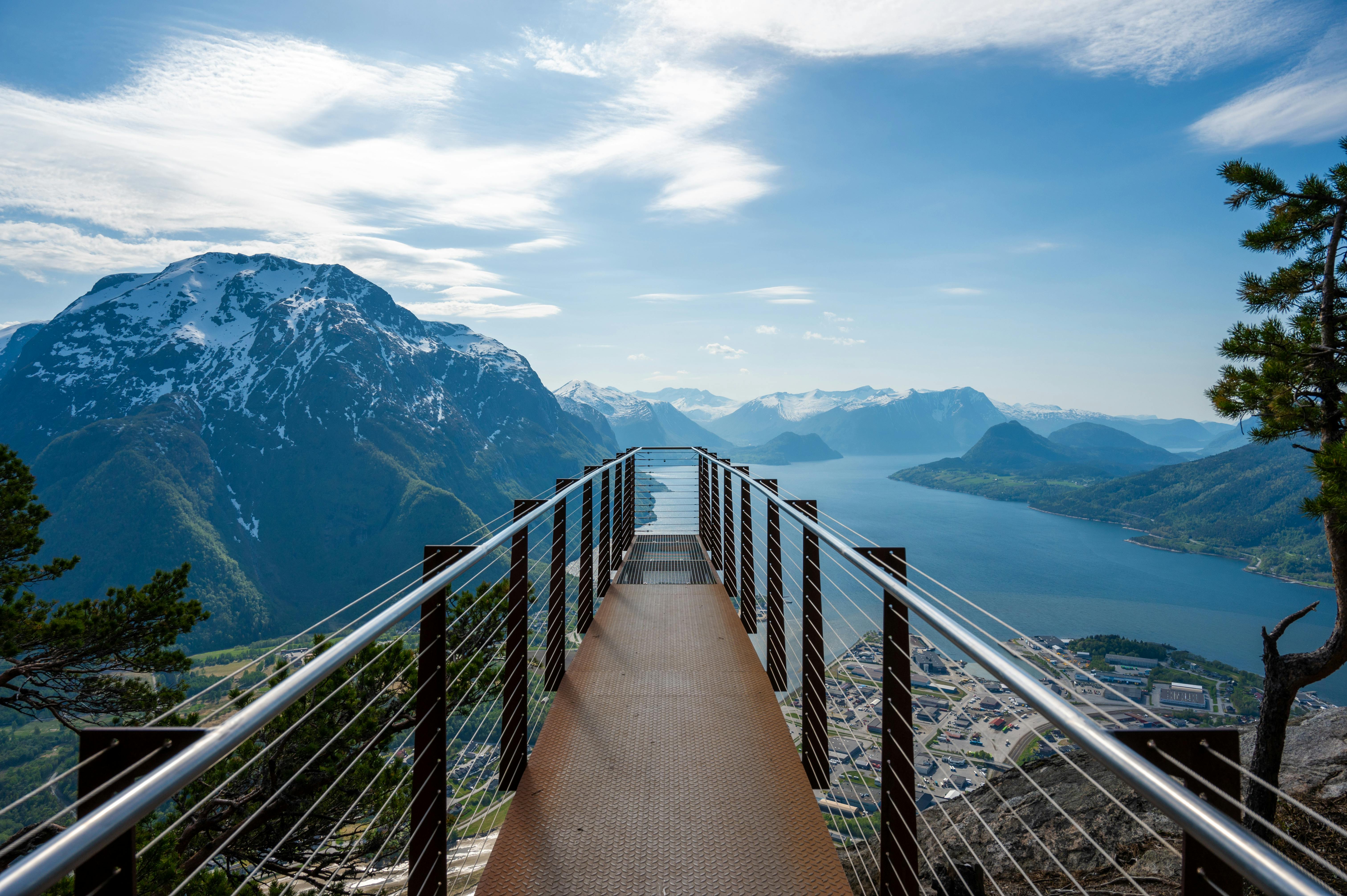
Images: Geirangerfjord from Løsta by Bloodworx (CC0, Wikimedia Commons). Ørnesvingen viewpoint by NorgeTravel.
ノルウェー旅行のプランを立てる
無料のインタラクティブなトリッププランナーで、ノルウェーのルートを計画し、認証済みのエコフレンドリーな宿泊と交通を予約し、現地のフェリー時刻表を確認できます。
Up Next: Keep Exploring
RIBフィヨルドサファリ ゲーランゲルフィヨルド:クルーズ船では味わえない体験
RIBフィヨルドサファリなら、セブンシスターズの滝からわずか15メートルの距離まで時速35ノットで大接近。このツアーの魅力、惜しい点、そして895ノルウェークローネという料金が本当に妥当なのかを正直にレビューします。
セブンシスターズの滝の下でカヤック体験:ガイランゲルフィヨルドをパドルで4時間
ガイランゲルでのカヤックツアーでは、8名のパドラーがセブンシスターズの滝のすぐ下、切り立った崖の壁に手が届くほどの距離に。4時間、1,550ノルウェークローネ、ドライスーツ貸与。この体験で得られるものと、どんな人におすすめなのかを詳しくご紹介します。
車で巡るガイランゲル:鷲の道、フライダルスユーヴェ、ダルスニッバを一日で満喫
鷲の道は11のヘアピンカーブで620メートルの高さを駆け上がり、ダルスニッバ(標高1,476メートル)からはフィヨルドが細い青い線となって眼下に広がります。ツアーバスと駐車スペースを奪い合うことなく、これらすべてを一日でドライブする方法をご紹介します。