レーヌブリンゲン:レーヌの村を見下ろす1,978段のシェルパの階段
ロフォーテン諸島で最も写真に撮られる絶景。書類上はDNTブルー(中級)トレイルですが、実際には年間50万人もの人々が列をなします。ここでは正直なハイキング方法をご紹介します。
レーヌブリンゲンは、レーヌ村の真上に448mそびえ立っています。トレイルは2016年から2021年にかけてネパール人シェルパによって築かれた1,978段の石段です。距離は短く、勾配は急で、常に混雑しています。9月には氷が張り始めます。これは、18年間のノルウェーでの山岳作業経験に基づいたトレイルガイドです。
The mountain does not care that you drove four hours to get here. That is the rule I start every trail guide with, and it applies to Reinebringen more than most places in Norway. This is a 448-metre peak on a DNT Blue trail. It is also the most photographed viewpoint in Lofoten, with an estimated 500,000 visitors a year on a path that did not officially exist until the Nepalese sherpas finished the stone staircase in 2021.
The numbers you see in guidebooks are inconsistent. The figure that matters: 1,978 steps. Not 1,566. Not 1,566 plus an addition. A dedicated Nepalese sherpa team, funded by Miljødirektoratet and Troms fylkeskommune, laid the final stones in 2021 after five working seasons (2016 through 2021). The staircase replaced a mud gully that was washing down into Reine village below and destroying the cliff face. That history is the context for everything that follows. You are walking on infrastructure that was built to keep the mountain from collapsing under your feet.
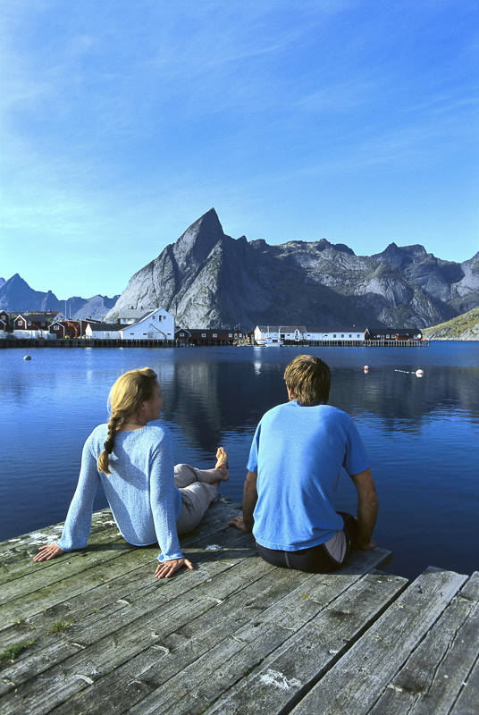
The honest grade
Reinebringen is classified DNT Blue (medium difficulty). In Norwegian grading terms, Blue means elevation gain under 600 metres, distance under 10 km, and no technical terrain. Reinebringen fits the criteria. It also compresses those 400-plus metres of elevation into roughly 1.5 kilometres of stone steps. The gradient averages 30 per cent. In places it steepens to 40.
What this means in practice: you will be climbing stairs for 60 to 90 minutes without a flat section to recover on. Fit hikers do it in 45 minutes. Most people take longer. The descent on the same stairs is harder on the knees than the climb is on the lungs. Trekking poles help. Proper hiking boots are not optional.
The DNT Blue grade does not mean easy. It means the trail is defined, the route is marked, and the surface has been engineered. It does not mean safe in all conditions. Three separate sections of the staircase have caused falls in wet weather in recent years. The upper 200 steps above the Y-junction are the steepest and the most exposed.
The route
The trailhead is a gravel lay-by on the E10 just before the Reine tunnel, roughly 800 metres south of Reine village centre. There is space for 20 to 25 vehicles. In July and August it fills by 08:00. After that, you park in Reine itself and walk the 10 minutes to the start.
From the lay-by, the path drops briefly through birch scrub to the base of the staircase. The steps begin at around 30 metres above sea level. You climb continuously through vegetation to approximately 200 metres, where the forest thins and the fjord opens up below on your right. A Y-junction at around 320 metres splits the route: the standard summit path continues up and to the left, and a shorter alternative viewpoint branches right. Most hikers take the left fork to the true summit at 448 metres.
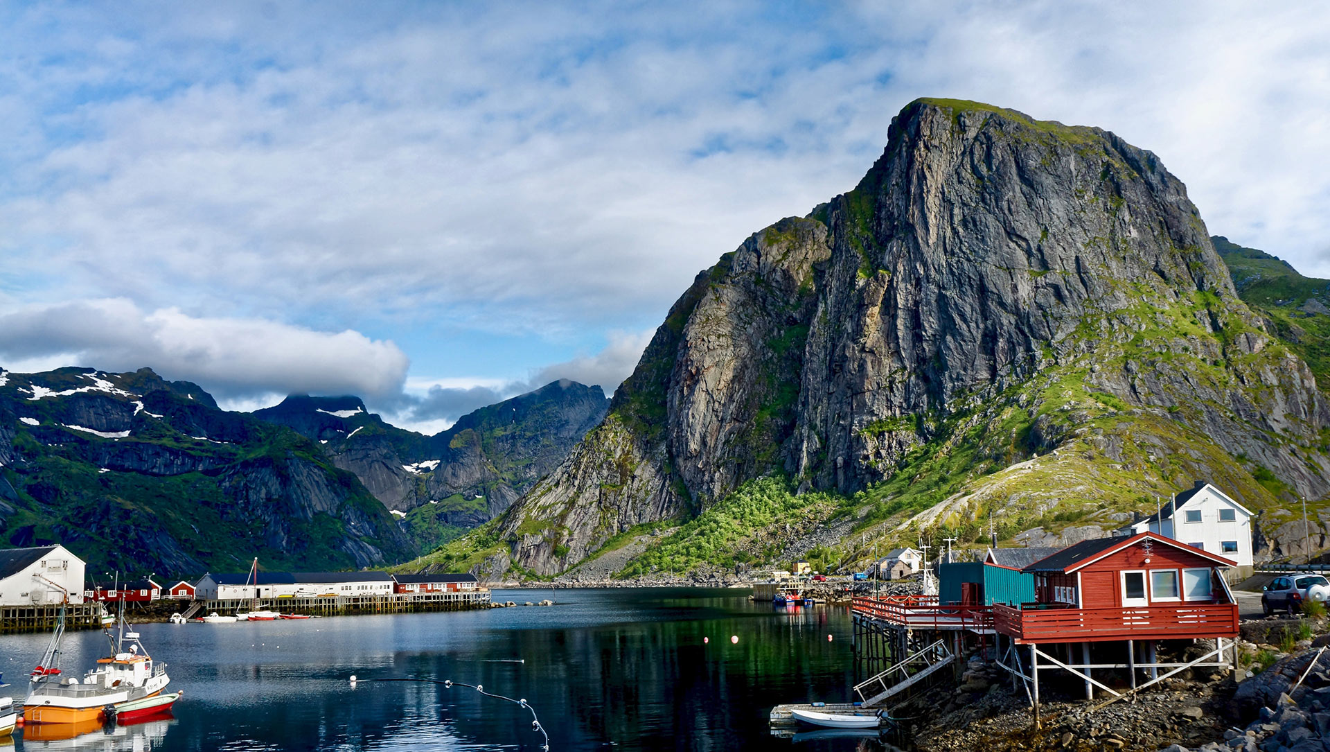
From the summit ridge, the view over Reinefjord and the village cluster (Reine, Hamnøy, Sakrisøy) is the shot that has anchored Lofoten's marketing for 15 years. There is no shelter on the summit. The wind off the Vestfjord cuts through most standard jackets even in July.
The turn-back rule
Reinebringen has three specific conditions that mean turning around is the correct decision:
- Wet stone steps. The granite is smooth from hundreds of thousands of boot strikes. Wet granite at a 30 per cent gradient is a slide, not a staircase. If the rain has been heavy in the last hour, wait or skip it.
- Ice on the steps. The first significant frost arrives in mid to late September. Once ice forms on the upper staircase, the route becomes a winter mountaineering problem. Microspikes help but do not solve it. The official maintenance closes the upper section intermittently from October through May.
- Strong wind above the forest line. Above 300 metres, the exposure to westerly wind increases sharply. At 15 m/s and above, the upper ridge is not a place for unprepared walkers. Turn back at the Y-junction and come back another day.
There is no shame in the descent. The same stairs you climbed up will still be there next week.
Gear for this specific route
- Hiking boots with an aggressive lug pattern. Trail runners work in dry conditions but slip on wet granite.
- Wind shell jacket (always). Light fleece for summit stops.
- Trekking poles, particularly for the descent. Reduce knee load by 25 to 30 per cent.
- Water (minimum 1 litre). There is no water source on the trail.
- Microspikes from late September through May. Non-negotiable if frost is in the forecast.
- Charged phone. Mobile coverage is reliable across the route.
The crowd reality
Roughly 500,000 people a year attempt this route. On a sunny July day between 10:00 and 14:00, the staircase is a single-file queue. The summit platform holds perhaps 30 people comfortably. It regularly has 150.
Two windows work. The first is 05:00 to 08:00. The light is good, the steps are empty, and the air is cold enough that you are climbing with a fleece on. The second is 18:00 to 21:00 in the midnight-sun window (28 May to 14 July), when the cruise visitors have returned to their ships and the summit empties out.
Outside those windows, expect to queue on the staircase. The engineered path is not wide enough for two-way traffic. Passing requires one party to step onto the vegetation (which is against the erosion-control rules the path was built to solve).
Fjellvettreglene on this route
The Norwegian Mountain Code applies everywhere. Four of the nine rules are directly load-bearing on Reinebringen:
- Rule 2: Adapt the trip to ability and conditions. The Blue grading assumes dry weather and daylight. Adjust for wet rock, wind, or shortened daylight in shoulder season.
- Rule 3: Pay attention to weather and avalanche forecasts. Check yr.no the evening before. The Lofoten microclimate can move from sun to horizontal rain in under 40 minutes.
- Rule 4: Be equipped to help yourself and others. Minimum: wind shell, water, charged phone, basic first aid.
- Rule 8: Turn back in time. There is no shame in retreat. The three turn-back triggers above are this rule applied to this specific route.
The logistics
| Detail | Information |
|---|---|
| Distance | 2 km round trip |
| Elevation gain | 420 m (summit 448 m) |
| Time | 2 to 3 hours round trip |
| DNT grade | Blue (medium) |
| Number of steps | 1,978 sherpa-built stone steps (completed 2021) |
| Season | June through mid-September reliable. Ice from late Sep. |
| Trailhead | E10 lay-by south of Reine village (20 to 25 spaces) |
| Parking fee | 100 NOK, paid at machine at the lay-by |
| Trailhead GPS | 67.9299°N, 13.0846°E |
| Mobile coverage | Available along entire route |
| Water on route | None. Carry 1 litre minimum. |
| Emergency | 112 (police/rescue), 113 (medical) |
Who should hike this
- Fit travellers with half a morning in Reine. Start at 05:00. Summit by 07:00. Down by 09:00. You have earned breakfast at Reine Rorbuer.
- First-time visitors to Lofoten. If you only do one hike in the archipelago, this is the shortest path to the view that defines Lofoten on every map and poster.
- Photographers with a tripod. The pre-dawn window (03:30 to 05:00 in June) gives empty steps and diffused light across Reinefjord.
Who should skip this
- Anyone with serious knee issues. The descent on 1,978 stone steps is the hardest part of the day on joints. Trekking poles reduce the load but do not eliminate it.
- Visitors in late autumn or winter. From October through May, the upper staircase is intermittently closed. Even when open, ice makes this a different route than the summer version.
- Travellers looking for solitude. This is the most-walked mountain in Lofoten. If you want a quiet ridge, hike Festvågtind above Henningsvær or Ryten above Kvalvika. Both deliver the same quality of view with a fraction of the traffic.
Marte Åsheim is the Mountain Safety Editor at NorgeTravel. DNT-certified guide with 18 years of experience across Jotunheimen, Rondane, and the Nordic peaks. She writes trail guides so that you come home afterward. She can be reached at hei@norgetravel.com.
Image: Lofoten scenic by Terje Rakke, Nordic Life, provided by Visit Northern Norway.
ノルウェー旅行のプランを立てる
無料のインタラクティブなトリッププランナーで、ノルウェーのルートを計画し、認証済みのエコフレンドリーな宿泊と交通を予約し、現地のフェリー時刻表を確認できます。
Up Next: Keep Exploring
RIBフィヨルドサファリ ゲーランゲルフィヨルド:クルーズ船では味わえない体験
RIBフィヨルドサファリなら、セブンシスターズの滝からわずか15メートルの距離まで時速35ノットで大接近。このツアーの魅力、惜しい点、そして895ノルウェークローネという料金が本当に妥当なのかを正直にレビューします。
セブンシスターズの滝の下でカヤック体験:ガイランゲルフィヨルドをパドルで4時間
ガイランゲルでのカヤックツアーでは、8名のパドラーがセブンシスターズの滝のすぐ下、切り立った崖の壁に手が届くほどの距離に。4時間、1,550ノルウェークローネ、ドライスーツ貸与。この体験で得られるものと、どんな人におすすめなのかを詳しくご紹介します。
車で巡るガイランゲル:鷲の道、フライダルスユーヴェ、ダルスニッバを一日で満喫
鷲の道は11のヘアピンカーブで620メートルの高さを駆け上がり、ダルスニッバ(標高1,476メートル)からはフィヨルドが細い青い線となって眼下に広がります。ツアーバスと駐車スペースを奪い合うことなく、これらすべてを一日でドライブする方法をご紹介します。