ルートティンデン、クヴァル島:エルスフィヨルドの絶景ハイキング
エルスフィヨルドボトンから644m上、DNTブルーに指定された山頂からは、4時間のウォーキングで360°の北極圏パノラマが広がります。クヴァル島で最も人気のある山頂には理由があります。
ルートティンデンはクヴァル島東部に位置し、標高644m。トロムソ中心部から車で45分です。標準ルートはエルスフィヨルドのフィンヴィカから登ります。往復6km、標高差600m、所要時間は4~5時間。DNTブルーに指定されており、最後に急なセクションがあります。夏と初秋のみ。
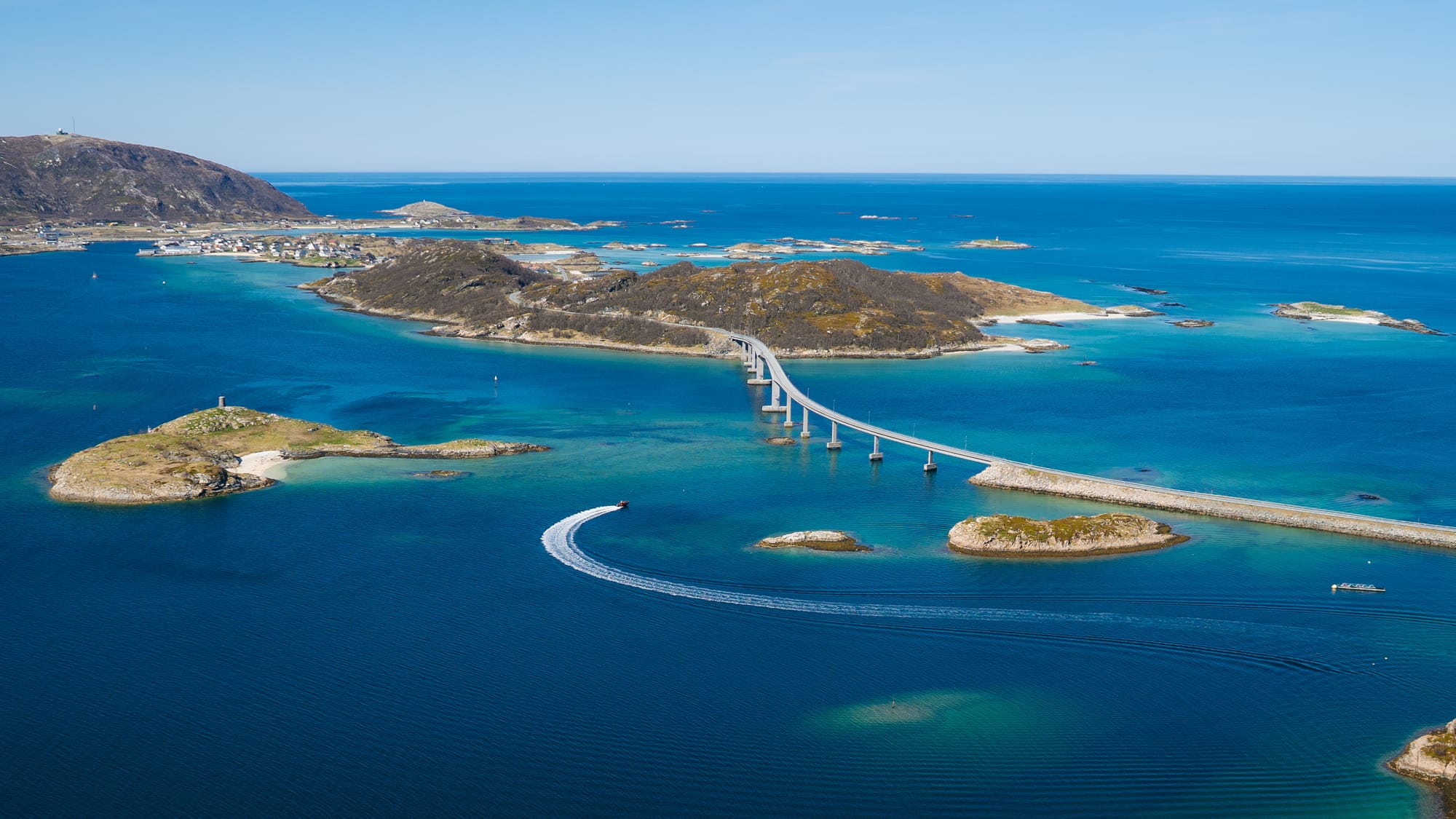
Kvaløya is the island west of Tromsø. 10 kilometers of bridge and coastal road separate it from the city. It is where Tromsø residents go when they want a mountain day without the full commitment of Tromsdalstinden, when they want the open coastal views that Fløya does not give, and when they want a summit they can actually reach on most days in the year.
Rødtinden is the Kvaløya hike locals recommend first. 644 meters, DNT Blue, a trailhead 45 minutes from the city, and a summit that gives you Ersfjord to the east, the Atlantic to the west, and the Lyngen Alps in silhouette on the far horizon. It is the mountain I take friends up when they have one day on Kvaløya and want to understand why we live here.
What this trail actually is
Rødtinden stands on the eastern side of Kvaløya, above the village of Ersfjordbotn at the head of Ersfjord. The standard ascent starts from a small parking area at Finnvika, on the north shore of the fjord. The trail climbs a birch-forested lower slope, breaks above the treeline at around 300m, and then follows a well-used path across heather and rock to the summit ridge.
The final 150 meters of elevation are the steepest section. The path becomes a scree and boulder scramble, not technical but demanding care in the wet. A single short section uses hands for balance, but there is no exposure that requires climbing experience.
The summit is a broad plateau rather than a point. Two cairns mark it. The 360° view is the reason to make the climb: Ersfjord directly below, Kvaløya's western peaks in the middle distance, the Lyngen Alps 40 km to the east, and on a clear day the horizon line of the Atlantic to the west.
Round trip is 6 kilometers. Elevation gain is 600 meters. Typical time is 4 to 5 hours, including a generous break at the summit.
Two routes, one summit
Route 1: From Finnvika. The standard approach. Parking for 8 to 10 cars at the trailhead, free. Trail starts through birch forest for 1.5 km, opens above the treeline, and climbs steadily to the summit ridge. Well-marked and well-worn. 3 km to the summit, 3 km back.
Route 2: From Ersfjordvegen (southern trailhead). Slightly longer at 7 km round trip, steeper lower section, less-used and more atmospheric. The view opens earlier because the trail climbs the exposed south face. Park at the Ersfjordvegen pull-off signed for the trail.
Most Tromsø residents use the Finnvika route. It is the faster option and holds the path better in wet conditions.
What works
- The view-to-effort ratio. 600 meters of gain buys you a panorama that covers three fjord systems and two mountain ranges. For a half-day investment, it is one of the most rewarding summits in the Tromsø area.
- The access. 45 minutes' drive from Tromsø centre via the Sandnessund bridge and the Kvaløyveien coastal road. No ferry, no timetable. You can be back in the city for dinner after a morning ascent.
- The Ersfjord view. The summit looks directly down on Ersfjord, one of the most photographed coastal valleys in Nord-Norge. The fjord is narrow and deep, with white-sand pockets at the head. In late afternoon, the light runs up the fjord and turns the water blue-green.
- The season. Rødtinden is snow-free from mid-June through early October in most years. This is a four-month window, longer than Tromsdalstinden. Late September often gives the clearest summits with the first dusting of autumn snow on the upper peaks.
What does not work
- The boulder scramble. The final summit push is steep and involves loose rock. It is not technical, but it is the section where most injuries happen. Descent is harder than ascent. Sturdy boots with ankle support make a real difference.
- The weather exposure. The summit is open on all sides. Wind speeds on the ridge are often double what you measured at the trailhead. Shell layer and insulating layer are essential even on a warm day at sea level.
- The parking. Finnvika parking holds 8 to 10 cars and fills on peak summer weekends. If the lot is full, park along Ersfjordvegen and walk the extra kilometer.
- The mud. The lower birch forest section becomes a mud trench after rain. It is not dangerous, but it is unpleasant. Waterproof boots rather than trail runners.
The honest assessment
Rødtinden is the Kvaløya mountain that works for the widest range of hikers. It is not a wilderness experience — on a July weekend you will share the summit with 20 to 40 people. It is not technically demanding — the hardest section is the final scramble and that is manageable in dry weather. But it delivers the view of Kvaløya that makes the rest of your Tromsø trip make sense.
Do this one on a clear afternoon. Time your summit for 17:00 to 19:00 in July for low sun and empty ridge. Bring food, take an hour at the top, and walk down into the light.
The logistics
| Detail | Information |
|---|---|
| Summit elevation | 644 m |
| Standard trailhead | Finnvika, Ersfjord (45 min drive from Tromsø centre) |
| Round trip distance | ~6 km |
| Elevation gain | ~600 m |
| Time on foot | 4–5 hours round trip |
| DNT grade | Blue (medium). Boulder scramble on final 150 m |
| Season | Mid-June to early October |
| Trail fee | Free |
| Parking | Free, ~8–10 spaces at Finnvika |
| Mobile coverage | Intermittent above 400 m, good at summit |
| Summit GPS | 69.7260°N, 18.5850°E |
| Emergency | 112 (rescue) |
What to bring
- Waterproof hiking boots with ankle support
- Shell jacket and warm layer (always)
- Water (1–1.5 liters) and lunch food
- Hat, gloves, buff
- Trekking poles recommended for the descent
- Map on phone plus backup physical map
- Headlamp if you plan to descend after 20:00 in September
Who should hike this
- Visitors with one half-day on Kvaløya and reasonable fitness
- Hikers building up to Tromsdalstinden — this is the test piece to see if the bigger summit is realistic
- Families with teenagers: the summit is manageable for most 13+ in proper boots
Who should skip this
- Anyone without proper hiking boots — the scramble is not forgiving of runners
- Winter visitors: this is a summer trail. Snow on the upper section from late October means ice-axe and crampon territory for experienced mountaineers only
- Visitors with under 5 hours free — the drive there and back alone consumes 1.5 hours
Bjørn Haugen is the Arctic Field Editor at NorgeTravel. He guides in Nord-Norge year-round and lives in Tromsø. He can be reached at hei@norgetravel.com.
Source data: Kvaløya trail network mapping by DNT Tromsø; local route descriptions verified with Ishavskysten Friluftsråd 2024.
ノルウェー旅行のプランを立てる
無料のインタラクティブなトリッププランナーで、ノルウェーのルートを計画し、認証済みのエコフレンドリーな宿泊と交通を予約し、現地のフェリー時刻表を確認できます。
Up Next: Keep Exploring
RIBフィヨルドサファリ ゲーランゲルフィヨルド:クルーズ船では味わえない体験
RIBフィヨルドサファリなら、セブンシスターズの滝からわずか15メートルの距離まで時速35ノットで大接近。このツアーの魅力、惜しい点、そして895ノルウェークローネという料金が本当に妥当なのかを正直にレビューします。
セブンシスターズの滝の下でカヤック体験:ガイランゲルフィヨルドをパドルで4時間
ガイランゲルでのカヤックツアーでは、8名のパドラーがセブンシスターズの滝のすぐ下、切り立った崖の壁に手が届くほどの距離に。4時間、1,550ノルウェークローネ、ドライスーツ貸与。この体験で得られるものと、どんな人におすすめなのかを詳しくご紹介します。
車で巡るガイランゲル:鷲の道、フライダルスユーヴェ、ダルスニッバを一日で満喫
鷲の道は11のヘアピンカーブで620メートルの高さを駆け上がり、ダルスニッバ(標高1,476メートル)からはフィヨルドが細い青い線となって眼下に広がります。ツアーバスと駐車スペースを奪い合うことなく、これらすべてを一日でドライブする方法をご紹介します。