ロルネスティンデン:リンゲンアルプスのキョーセン谷を見下ろす尾根道ハイキング
リンゲン半島の非氷河側にあるDNT赤(難易度高)指定の尾根登り。標高差900m。高度感のある急峻な最終尾根。そしてリンゲンフィヨルドを一望できる山頂からの絶景。
リンゲンアルプスのキョーセン谷直上にあるロルネスティンデン(標高992m)。往復8km、標高差900m、所要時間5〜6時間。DNT赤(難易度高)指定で、高度感のある最終尾根が特徴です。氷河がないためロープチームは不要ですが、状況によっては引き返す判断が必要となる本格的な高山ルートです。
Rørnestinden is one of the non-glaciated peaks that built Lyngen's reputation with intermediate ski tourers and summer ridge hikers. At 992 metres it is not the highest in the range, but the final 200-metre ridge is exposed, the approach is steep, and the summit looks straight across the Lyngenfjord at the big glaciated faces on the other side. It is a full alpine day without the glacier gear requirement.
This is DNT Red. It is not Besseggen Red. The scrambling is shorter but the ridge has real consequence. If you have not spent time on exposed ridges before, do Store Kjostind's southwest flank first and build up.
The honest grade
Rørnestinden is DNT Red: strenuous, with scrambling and exposure. In summer it is a hands-on ridge, not a hike. The ridge itself is narrow in places. There are no fixed chains, no marked bolts. If cloud closes on the ridge, navigation gets difficult fast because the sides drop steeply on both flanks.
In ski-touring season, Rørnestinden is a committing objective. The approach slope from the Kjosen valley is 35 to 40 degrees in places. This is avalanche terrain. Bring a transceiver, shovel, and probe, and know how to use them under pressure. Avalanche Level 2 skills are the baseline for anyone touring here unguided.
The route (summer)
Trailhead. Park at the small gravel area signed for Rørnestinden on the E6 between Oteren and Skibotn at the mouth of the Kjosen valley. Look for the marked path. Limited parking, 8 to 10 cars.
Lower section. The trail climbs steeply through birch forest for 300 metres of gain, then emerges above the tree line onto open tundra. 60 to 80 minutes.
Middle section. Open slope climbing across scree and grass toward the summit ridge. Marker cairns visible in clear weather. Gradient increases steadily. 60 to 90 minutes.
Summit ridge. The final 200 metres of elevation gain happens on a narrow ridge with scrambling and exposure on both sides. Hands come out of pockets. Do not rush. The rock is generally solid granite with clear holds. 45 to 60 minutes.
The turn-back rule
- Cloud on the ridge. Navigation on the summit ridge in poor visibility is a different problem than in clear weather. If cloud is down to 800 metres, turn back at the sub-summit.
- Wind above 15 m/s. The ridge is too narrow to be safe at that wind speed. Descend.
- Wet rock on the ridge. The scrambling sections are slippery when wet. Allow rock to dry before committing to the upper ridge.
- Rising snow-line in late season. Fresh snow on the summer ridge changes the route to winter conditions. Reverse.
Gear for this route (summer)
- Alpine hiking boots with stiff sole. Trail runners are wrong for this ridge.
- Wind shell, insulation layer, spare gloves. The summit is 1,000 metres above sea level and windy.
- Helmet. Not ironic. Loose rock can be kicked down from above on the popular section.
- Map, compass, and GPS. Summit ridge in cloud is not a phone-only problem.
- Water (2 litres). No reliable source above 400 metres.
- First aid kit. A sprained ankle 3 kilometres out and 900 metres up is a long rescue.
Fjellvettreglene on this route
Four rules of the Norwegian Mountain Code are directly load-bearing on Rørnestinden:
- Rule 2: Adapt the trip to ability and conditions. DNT Red is the grade. Fitness and scrambling experience are baseline.
- Rule 3: Pay attention to weather and avalanche forecasts. In ski season, this route is avalanche terrain. Check varsom.no the night before and the morning of.
- Rule 7: Use a map and compass. Phone-only navigation is not enough on the summit ridge in cloud.
- Rule 8: Turn back in time. The ridge is where the turnarounds happen. Do it.
The logistics
| Detail | Information |
|---|---|
| Summit elevation | 992 m |
| Distance | 8 km round trip |
| Elevation gain | 900 m |
| Time | 5 to 6 hours round trip |
| DNT grade | Red (strenuous, exposed ridge) |
| Season | July to September (summer). Ski touring February to May. |
| Trailhead | E6 at the Kjosen valley, between Oteren and Skibotn |
| Parking | Gravel lay-by, 8 to 10 cars, free |
| Trailhead GPS | 69.4390°N, 20.1770°E |
| Mobile coverage | Patchy above 600 metres |
| Emergency | 112 (police/rescue), 113 (medical) |
Who should hike this
- Experienced ridge walkers. If you have done Hurrungane, Romsdalseggen, or similar, this is within your range.
- Ski tourers in spring looking for a harder objective. The south and east aspects give a long ski descent in the right conditions.
- Photographers wanting the view back at the glaciated peaks. Rørnestinden looks straight at Store Kjostind, Tafeltinden, and the Jiehkkevárri massif.
Who should skip this
- Anyone without scrambling experience. The summit ridge is not optional. There is no bypass.
- Travellers in poor weather. This is not a route to force. Wait a day.
- First-time visitors to Lyngen in summer. Do Store Kjostind's southwest flank first. Build up.
Marte Åsheim is the Mountain Safety Editor at NorgeTravel. DNT-certified guide with 18 years of experience across Jotunheimen, Rondane, and the Nordic peaks. She writes trail guides so that you come home afterward. She can be reached at hei@norgetravel.com.
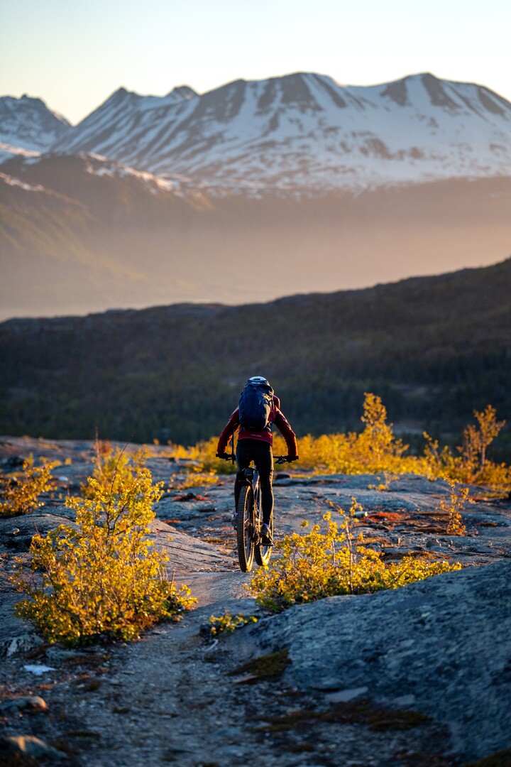
Image: Lyngen Alps ridge view by Petr Pavlíček, provided by Visit Lyngenfjord.
ノルウェー旅行のプランを立てる
無料のインタラクティブなトリッププランナーで、ノルウェーのルートを計画し、認証済みのエコフレンドリーな宿泊と交通を予約し、現地のフェリー時刻表を確認できます。
Up Next: Keep Exploring
RIBフィヨルドサファリ ゲーランゲルフィヨルド:クルーズ船では味わえない体験
RIBフィヨルドサファリなら、セブンシスターズの滝からわずか15メートルの距離まで時速35ノットで大接近。このツアーの魅力、惜しい点、そして895ノルウェークローネという料金が本当に妥当なのかを正直にレビューします。
セブンシスターズの滝の下でカヤック体験:ガイランゲルフィヨルドをパドルで4時間
ガイランゲルでのカヤックツアーでは、8名のパドラーがセブンシスターズの滝のすぐ下、切り立った崖の壁に手が届くほどの距離に。4時間、1,550ノルウェークローネ、ドライスーツ貸与。この体験で得られるものと、どんな人におすすめなのかを詳しくご紹介します。
車で巡るガイランゲル:鷲の道、フライダルスユーヴェ、ダルスニッバを一日で満喫
鷲の道は11のヘアピンカーブで620メートルの高さを駆け上がり、ダルスニッバ(標高1,476メートル)からはフィヨルドが細い青い線となって眼下に広がります。ツアーバスと駐車スペースを奪い合うことなく、これらすべてを一日でドライブする方法をご紹介します。