Rv55 ソグネフィエル ドライブ 2026年:ロムからガウプネまで108km、最高地点ファンテスタイン1,434m
北欧最高峰の山岳道路。5月下旬から季節限定で開通します。ネドレ・オスカーシャウグ、メーフィエレット、ソグネフィエルシュッタ、トゥルタグロには、国立観光ルートの公式展望台があります。現在のルートの運行状況と、通過時期が重要である理由をご紹介します。
Rv55ソグネフィエルは、グドブランド谷のロムとルストラフィヨルドのガウプネを結ぶ全長108kmの道で、ソグネフィエルシュッタ近くのファンテスタイン地点で標高1,434mの最高地点に達します。この道路は季節限定で、通常は5月下旬から11月上旬まで開通します。2024年シーズンは落石により中止となりました。確認済みのルート、展望台、そして2026年の開通状況をこちらでチェックしてください。
The Rv55 is on every Norwegian National Tourist Route list and appears in every fjord itinerary. The description in older guides is some version of "spectacular mountain scenery." Here is the practical 2026 version: 108 km between Lom and Gaupne, crossing a 1,434-meter plateau at Fantesteinen, with official viewpoints designed by Norwegian architects, one staffed mountain lodge at the highest point, and a Jostedalsbreen outlet glacier accessible via a side road at the western end. Drive time is 2.5 to 3 hours without stops. In clear weather in June it is one of the best drives in Europe. In low cloud and rain it is a narrow road with hairpin bends and limited guardrail. Both are part of the same route.
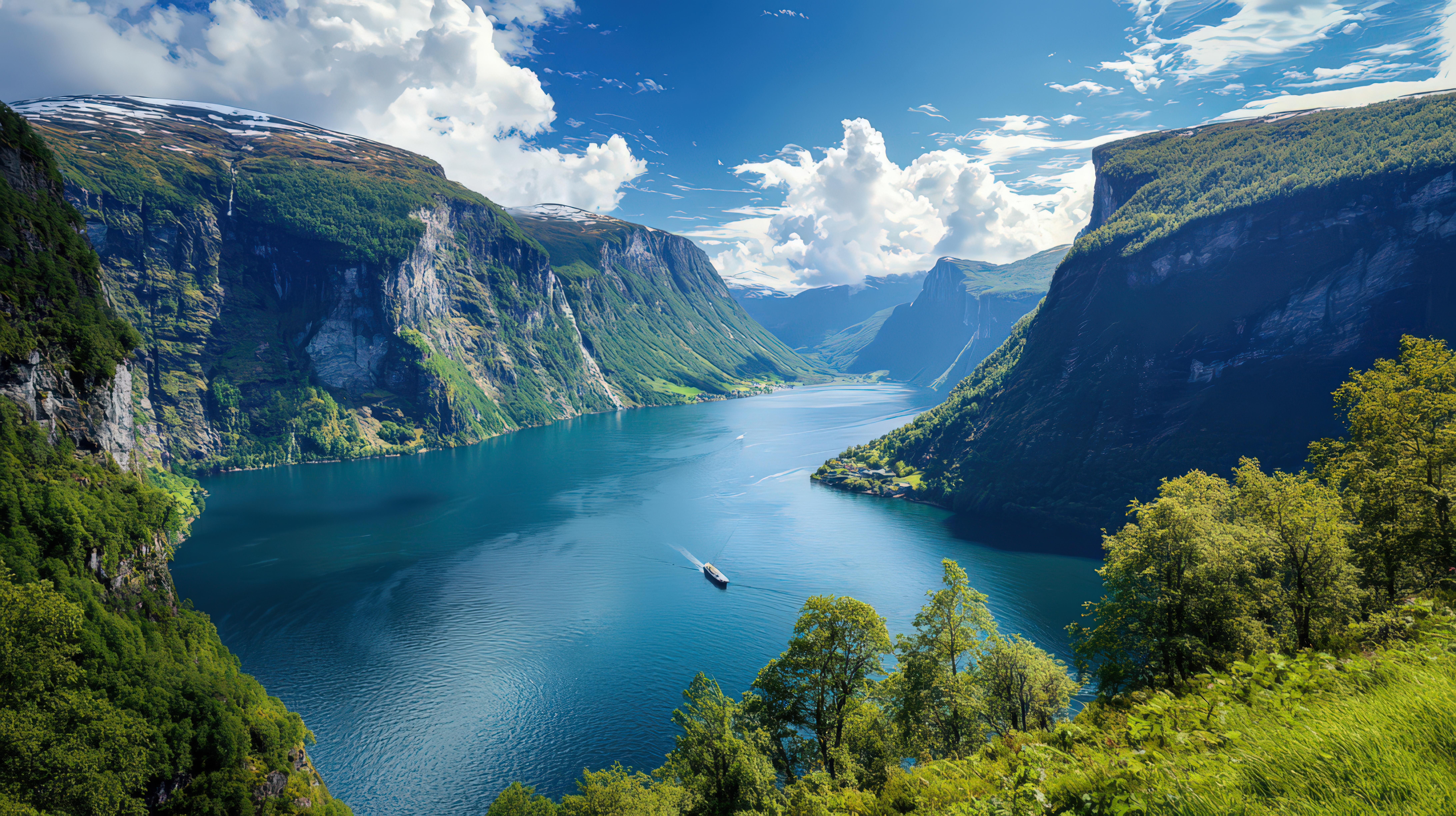
The route: Lom to Gaupne (or reverse)
The National Tourist Route runs Lom to Gaupne, 108 km. This is the correct endpoint information. Older articles that describe the route as "Sogndal to Lom" are wrong. Sogndal sits on Rv5 and E39, not Rv55. The western terminus of Rv55 is Gaupne, at the head of Lustrafjord. From Gaupne, the road climbs through Jostedalen and over the pass to Lom in Gudbrandsdalen.
Driving west to east (Gaupne to Lom): the road follows Lustrafjord north, then climbs through Skjolden and Fortun into the Jotunheimen massif. The Turtagrø section delivers the first high views toward the Hurrungane range. The summit at Fantesteinen sits near Sognefjellshytta. The descent east into Bøverdalen drops you down to Lom.
Driving east to west (Lom to Gaupne): the ascent from Lom climbs Bøverdalen, crosses Fantesteinen, and drops down the western side through Turtagrø and Fortun to Skjolden and Gaupne. The concentrated mountain scenery sits in the middle third of the drive.
The official viewpoints
Rv55 is part of the Nasjonale turistveger programme, which means the viewpoints are architect-designed pull-outs, not just road-shoulder gravel. Four are official stops in 2026.
- Nedre Oscarshaug. Architect Carl-Viggo Hølmebakk. A viewing scope identifies the named peaks of the Hurrungane range across the valley. This is the best stop for understanding what you are looking at on the western approach.
- Oscarshaug. Separate viewpoint nearby, named for King Oscar II, who crossed Sognefjellet in 1860.
- Mefjellet. Stone sculpture by Knut Wold frames the Fanaråken glacier view.
- Sognefjellshytta. The rest area at the pass high point, 1,400 meters. Staffed lodge with meals, fuel for people, and an emergency refuge in bad weather.
- Turtagrø. On-route waypoint, historic hotel, and base for Hurrungane climbing.
Note: Valdresflye is not on Rv55. It is the summit of Fv51, a separate National Tourist Route, further east. Older NorgeTravel copy referencing "Valdresflye viewpoint near Bøvertun" was wrong. Røisheim is also not a viewpoint. It is a historic coaching inn in Bøverdalen, worth a stop but not an official National Tourist Route pull-out.
The Nigardsbreen detour
Nigardsbreen is an outlet arm of Jostedalsbreen, the largest glacier on mainland Europe. It is NOT accessed directly from Rv55. From Gaupne, take Rv604 north into Jostedalen, approximately 30 km to the Breheimsenteret visitor centre. The side trip adds roughly 90 minutes each way plus time at the ice.
Breheimsenteret is open daily from 1 May to 30 September in 2026. From the visitor centre, a short walk (or the small electric boat across Nigardsbrevatnet) brings you to the ice front. Guided ice walks are run by Jostedalen Breførarlag (bfl.no), 1 June to 15 September 2026. The short hike is approximately 4.5 hours including transport. Book ahead in July and August.
When it opens and when it closes
The Rv55 Sognefjellet is a seasonal road. It typically opens in late May and closes in late October or at first sustained snowfall, whichever comes first. The exact opening date varies by year and is determined by the spring snow-clearing operation. Check vegvesen.no before you drive.
Important caveat: the 2024 summer season was cancelled after rockfalls closed the road for the year. Do not assume "Rv55 is always open in July." Confirm current status on vegvesen.no (search the route number and check for real-time notices). The road can close briefly mid-season for maintenance or weather.
What works
- Clear weather in June. Once the road has opened, June combines remaining snow walls at the summit with clear plateau visibility and significantly less traffic than July. This is the best month for the crossing.
- Stopping at Nedre Oscarshaug early. The viewing scope helps you identify the peaks you are about to drive past. If you skip it, the rest of the drive loses context.
- Sognefjellshytta as a break point. The staffed lodge at 1,400 meters is roughly the mid-point of the mountain section. Hot food, shelter if conditions deteriorate.
- Combining with the Nigardsbreen detour. If you have a full day, Gaupne in the morning, Nigardsbreen ice walk, then the Rv55 climb in the afternoon. Overnight in Lom or Sognefjellshytta.
What does not work
- Large motorhomes and wide caravans. Rv55 has narrow sections and switchbacks, particularly near Turtagrø. Norway's general maximum vehicle width is 2.55 meters. Rental motorhomes at the upper end of that range are slow and stressful on this road in peak traffic.
- Assuming the road is open. After the 2024 closure, the lesson is clear: confirm status on vegvesen.no the morning of the crossing.
- Evening crossings without accommodation arranged. The summit section has limited services. Book Sognefjellshytta, Turtagrø, Lom, or Gaupne ahead in July and August.
- Trusting phone GPS for the detour to Nigardsbreen. The junction is signed in Gaupne. Follow Rv604 north, not any shortcut the app suggests.
Fuel and services
Fill up in Lom (Circle K) before starting the climb eastbound. Westbound, fuel in Gaupne before continuing up into Jostedalen or over the pass. There is no reliable mid-route fuel station at the summit. Sognefjellshytta provides meals and accommodation, not fuel for vehicles.
Practical information (2026)
- Route: Rv55 Sognefjellet National Tourist Route, Lom to Gaupne (or reverse)
- Distance: 108 km
- Drive time: 2.5 to 3 hours without stops. Allow 4 to 5 hours with viewpoints.
- Highest point: 1,434 meters at Fantesteinen, near Sognefjellshytta. Northern Europe's highest mountain pass road.
- Season: Typically late May to late October. Check vegvesen.no for 2026 opening date.
- 2024 note: Road was closed the entire summer season following rockfalls. Confirm current status before planning around the route.
- Toll: No road toll
- Official viewpoints: Nedre Oscarshaug, Oscarshaug, Mefjellet, Sognefjellshytta, Turtagrø
- Sognefjellshytta: Staffed lodge at 1,400 m with meals and accommodation
- Nigardsbreen access: Via Rv604 from Gaupne (not directly from Rv55). Breheimsenteret open 1 May to 30 September 2026. Guided ice walks via Jostedalen Breførarlag 1 June to 15 September.
- Fuel: Lom (Circle K) eastbound. Gaupne westbound. No reliable summit fuel.
- Source for road status: vegvesen.no
- Source for National Tourist Route: nasjonaleturistveger.no
The Rv55 is the correct route between Sognefjord and Jotunheimen in summer. It earns its National Tourist Route designation. The two things that matter: confirm the road is actually open the morning you plan to drive, and allow time for the official viewpoints. The road itself is the attraction. Driving it in a hurry defeats the point.
ノルウェー旅行のプランを立てる
無料のインタラクティブなトリッププランナーで、ノルウェーのルートを計画し、認証済みのエコフレンドリーな宿泊と交通を予約し、現地のフェリー時刻表を確認できます。
Up Next: Keep Exploring
RIBフィヨルドサファリ ゲーランゲルフィヨルド:クルーズ船では味わえない体験
RIBフィヨルドサファリなら、セブンシスターズの滝からわずか15メートルの距離まで時速35ノットで大接近。このツアーの魅力、惜しい点、そして895ノルウェークローネという料金が本当に妥当なのかを正直にレビューします。
セブンシスターズの滝の下でカヤック体験:ガイランゲルフィヨルドをパドルで4時間
ガイランゲルでのカヤックツアーでは、8名のパドラーがセブンシスターズの滝のすぐ下、切り立った崖の壁に手が届くほどの距離に。4時間、1,550ノルウェークローネ、ドライスーツ貸与。この体験で得られるものと、どんな人におすすめなのかを詳しくご紹介します。
車で巡るガイランゲル:鷲の道、フライダルスユーヴェ、ダルスニッバを一日で満喫
鷲の道は11のヘアピンカーブで620メートルの高さを駆け上がり、ダルスニッバ(標高1,476メートル)からはフィヨルドが細い青い線となって眼下に広がります。ツアーバスと駐車スペースを奪い合うことなく、これらすべてを一日でドライブする方法をご紹介します。