ステガスタイン 2026:アウランズフィヨルドを見下ろす、絶景ルートFv243沿いの標高650mの展望台
ビョルガヴェーゲン(Fv243)の絶景ルート沿いの斜面から突き出すように建てられた、長さ30メートル、幅4メートルの展望台。サンダースとヴィルヘルムセンが設計し、2006年にオープンしました。訪問時期と、昼間の観光バスの行列を避ける方法をご紹介します。
ステガスタインは、絶景ルートFv243沿いに位置し、アウランズフィヨルドから650メートルの高さにある、長さ30メートル、幅4メートルの展望台です。ノルウェー絶景ルートプログラムのためにサンダースとヴィルヘルムセンが設計しました。入場は無料。40台収容の駐車場は、ピークシーズンには午前11時から午後4時の間に満車になります。代替手段として、フロムからのシャトルバスをご利用ください。
The Stegastein viewpoint gets booked into itineraries the way the Trollstigen gets booked. Clients read a list, they see the photograph, they plug the coordinates into Google Maps, and they arrive in a rental car at 13:00 to find a 40-space car park already full. What the photograph does not show is the coach queue, the tour group on the platform, or the narrow switchback road you share with a Dutch campervan on the way down.
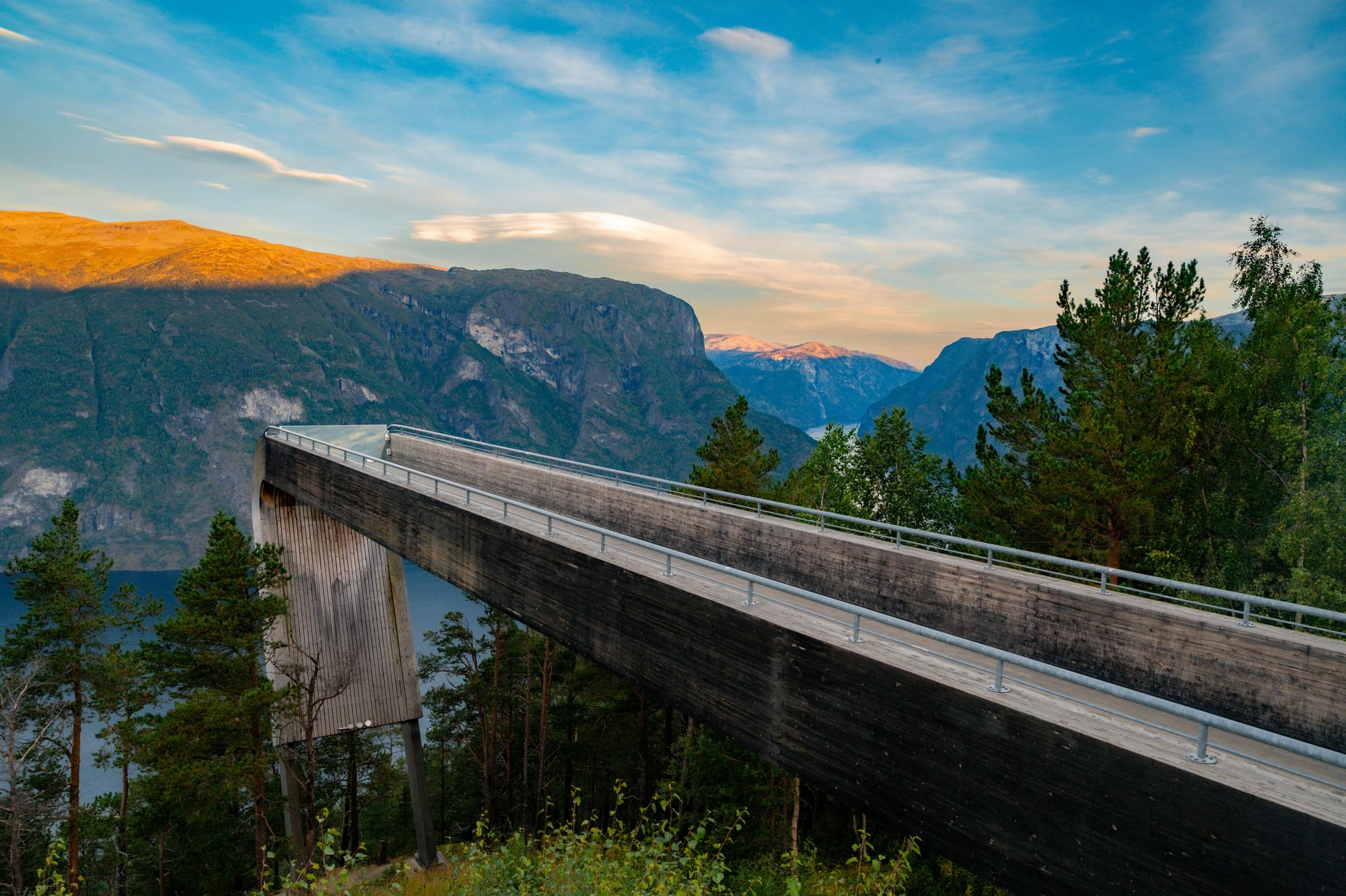
The platform itself is 30 metres long and 4 metres wide, and it projects out from the hillside at 650 metres above Aurlandsfjord. The laminated pine structure ends in a glass wall angled downward so the fjord falls away in front of you without visual break. Todd Saunders and Tommie Wilhelmsen designed it for the Norwegian Scenic Route programme. It opened in 2006. It remains one of the most photographed pieces of contemporary architecture in western Norway.
What this viewpoint actually is
Stegastein sits on the Bjørgavegen, the Fv243 mountain road that climbs from Aurland village at sea level to Aurlandsfjellet at roughly 1,300 metres, then drops toward Lærdal as the Snow Road. The road is open summer only (typically late May to mid-October, snow dependent) and is part of the Nasjonal Turistveg network.
The platform is free to visit. There is no entry fee, no ticket, no booking. What it has is a car park with 40 spaces, which in July and August is routinely full between 11:00 and 16:00. Coaches from Flåm cruise calls are the biggest load. If you arrive in a rental car at midday in peak season, you will queue for parking, you will share the platform with 80 other people, and you will budget 90 minutes for what should have been 30.
How to reach Stegastein
Option 1: Drive the Bjørgavegen. From Aurland village, the Fv243 switchbacks up the mountainside. Approximately 6.5 km and 650 metres of elevation, about 20 minutes in good conditions. The road is narrow with passing places. Caravans and trailers are not recommended. Parking at Stegastein: 40 spaces, free. In peak season, arrive before 10:00 or after 17:00.
Option 2: Take the shuttle from Flåm. A summer shuttle from Flåm operates the run up to Stegastein. Check fjordtours.com or the Flåm Visitor Centre for the current operator and schedule. This is the right choice for cruise passengers without a car and for travellers who do not want to drive the switchbacks.
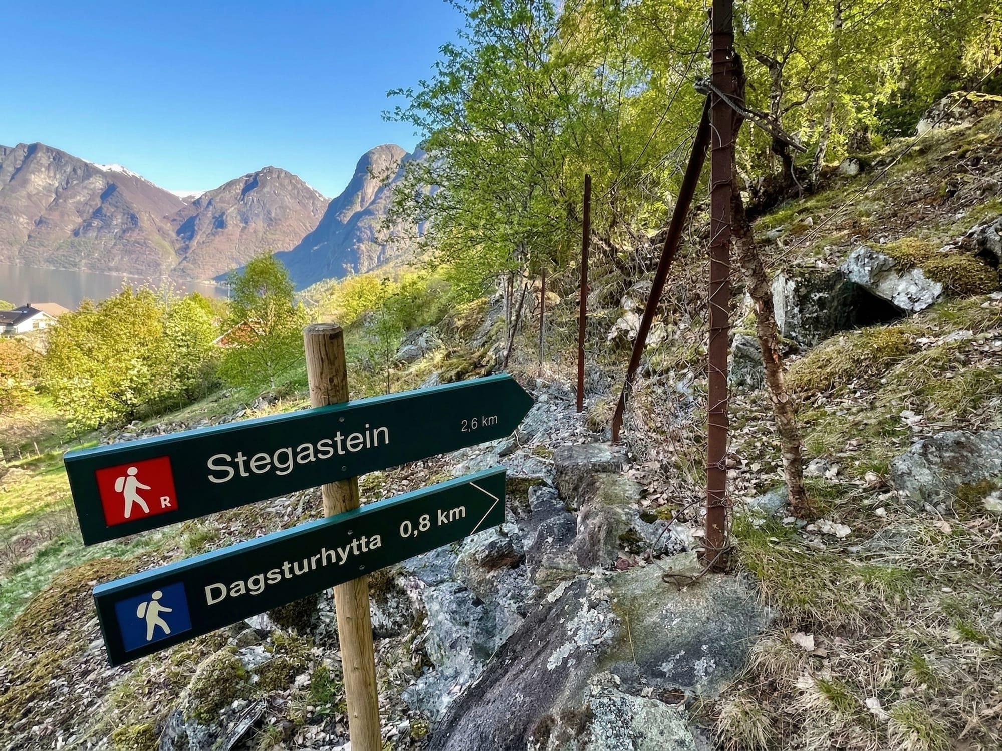
Option 3: Hike up from Aurland. Local walking routes climb from the Aurland valley floor to the plateau at Prest and Stegastein. These are not engineered tourist paths and signposting is limited. If this appeals, consult ut.no for the current route, load the track offline, and allow a full day for the 650-metre climb and descent. Most visitors drive or take the shuttle.
What works
- The platform design. Saunders and Wilhelmsen built Stegastein from laminated pine and they built it to disappear. The wooden structure curves out from the hillside and ends in a glass wall angled down toward the fjord. You walk to the end, you look down, and there is nothing between you and the water 650 metres below. The architecture does its job. It gets out of the way of the view.
- Free access. No entry fee, no ticket, no booking. This is unusual for a photographed viewpoint of this calibre. The cost is parking availability in peak hours, not money.
- The drive itself. If you do drive, the Bjørgavegen is part of the experience. Hairpin turns with the fjord expanding behind you at each switchback. The road continues past Stegastein to Aurlandsfjellet at roughly 1,300 metres and then drops on the Snow Road to Lærdal. This is one of the best mountain drives in Norway.
- The shuttle option. For travellers without a car, and for anyone uncomfortable on narrow mountain roads, the summer shuttle from Flåm solves the access problem.
What does not work
- Peak-season crowding at the platform. Between 11:00 and 16:00 from late June through mid-August, expect 60 to 100 people on the platform at once. The 30 by 4 metre deck is not small, but it is not empty either. The quiet photograph you saw online was taken at 07:00 or 20:00. Plan accordingly.
- The road closes in winter. The Bjørgavegen and the Aurlandsfjellet scenic route are typically closed from mid-October to late May. If you are visiting between November and April, Stegastein is not on your list.
- No facilities at the platform. There is a small wooden toilet block at the car park and nothing else. No café, no shop, no bench, no shelter. In rain, you get wet. In cold, you get cold. Bring what you need.
- Vehicle restrictions. Caravans and trailers are not recommended on the Fv243. The passing places are narrow and the gradient is steep.
The honest assessment
Stegastein is worth visiting. The platform design is genuinely good, the view of Aurlandsfjord is among the best in the Sognefjord system, and the architectural context matters. This is part of the Nasjonal Turistveg programme that commissioned some of Norway's best contemporary infrastructure design.
What is not worth doing is queuing for parking at midday and then queuing to get to the end of the platform. If you are driving, drive early or late. If you are coming off a cruise call in Flåm, take the shuttle rather than a taxi. If you want effort on your day, the Prest summit 8 km further up the Bjørgavegen gives you a DNT Red climb with a higher sightline onto the same fjord.
The logistics
| Detail | Information |
|---|---|
| Platform name | Stegastein (Nasjonal Turistveg Aurlandsfjellet) |
| Elevation | 650 m above Aurlandsfjord |
| Platform dimensions | 30 m long, 4 m wide |
| Architect | Todd Saunders and Tommie Wilhelmsen, opened 2006 |
| Drive from Aurland | 6.5 km on Fv243, around 20 minutes in good conditions |
| Season | Late May to mid-October, road snow dependent |
| Entry fee | Free |
| Parking | 40 spaces, free. Full 11:00 to 16:00 in peak season. |
| Vehicle restrictions | Caravans and trailers not recommended on Fv243 |
| Facilities at platform | Toilet only. No café, no shelter. |
| Best time | Before 10:00 or after 17:00 in summer |
| Shuttle from Flåm | Summer season, check fjordtours.com |
| Emergency | 112 (police/rescue) or 113 (medical) |
Driving the Fv243
The Bjørgavegen is narrow, steep, and has passing places rather than two full lanes in several sections. Drive at a moderate pace. Give way to uphill traffic. Take the viewpoint lay-bys above and below the platform if you want to photograph the switchbacks without blocking the road.
In rain, the road surface is slick. In early or late season, patches of ice remain on the upper sections after a cold night. The road closes in winter. Check vegvesen.no for current status if you are driving in May or October.
Who should visit Stegastein
- Any traveller with half a day in Aurland or Flåm. The drive up, the platform, and the drive back fill 90 minutes to 2 hours. Combined with a meal in Aurland or a Nærøyfjord cruise, this is a complete afternoon.
- Cruise passengers on the Flåm shuttle. The shuttle plus 45 minutes at the platform is the right form factor for a short port call.
- Road trippers continuing to Lærdal. The Aurlandsfjellet scenic route continues past Stegastein over the plateau and drops to Lærdal via the Snow Road. If you are driving east anyway, Stegastein is on the route.
Who should skip Stegastein
- Anyone visiting between mid-October and late May. The road is closed. The platform is inaccessible. Come back in June.
- Anyone without at least 90 minutes to spare on the visit. The round trip from Aurland takes that much even in off-peak conditions. Rushing it means driving the switchbacks faster than you should.
- Anyone who dislikes exposed viewpoints. The platform ends in a glass wall with the fjord 650 metres below. The guardrail is a simple metal bar. If that sounds stressful to read, the platform itself will be stressful.
Ingrid Solheim is the Fjord Logistics Editor at NorgeTravel. She spent eleven years putting tourists into rental cars in Bergen and watching them drive off with itineraries that were never going to work. Her guides are written so that does not happen to you. She can be reached at hei@norgetravel.com.
ノルウェー旅行のプランを立てる
無料のインタラクティブなトリッププランナーで、ノルウェーのルートを計画し、認証済みのエコフレンドリーな宿泊と交通を予約し、現地のフェリー時刻表を確認できます。
Up Next: Keep Exploring
RIBフィヨルドサファリ ゲーランゲルフィヨルド:クルーズ船では味わえない体験
RIBフィヨルドサファリなら、セブンシスターズの滝からわずか15メートルの距離まで時速35ノットで大接近。このツアーの魅力、惜しい点、そして895ノルウェークローネという料金が本当に妥当なのかを正直にレビューします。
セブンシスターズの滝の下でカヤック体験:ガイランゲルフィヨルドをパドルで4時間
ガイランゲルでのカヤックツアーでは、8名のパドラーがセブンシスターズの滝のすぐ下、切り立った崖の壁に手が届くほどの距離に。4時間、1,550ノルウェークローネ、ドライスーツ貸与。この体験で得られるものと、どんな人におすすめなのかを詳しくご紹介します。
車で巡るガイランゲル:鷲の道、フライダルスユーヴェ、ダルスニッバを一日で満喫
鷲の道は11のヘアピンカーブで620メートルの高さを駆け上がり、ダルスニッバ(標高1,476メートル)からはフィヨルドが細い青い線となって眼下に広がります。ツアーバスと駐車スペースを奪い合うことなく、これらすべてを一日でドライブする方法をご紹介します。