自驾盖朗厄尔:一天之内游览老鹰之路、飞来峡谷观景台和达尔斯尼巴
三处绝美观景台,海拔落差达1500米,一路蜿蜒而上,将盖朗厄尔峡湾尽收眼底,仿佛一幅地图在你脚下展开。
老鹰之路共有11个发夹弯,海拔攀升620米。达尔斯尼巴观景台海拔1476米,盖朗厄尔峡湾在脚下犹如一条纤细的蓝色丝带。本攻略将教您如何一天内自驾游览这两处景点,轻松避开旅游大巴,不再为停车位烦恼。
Every visitor to Geiranger sees the fjord from the water. The ferry takes you past the waterfalls. The RIB puts you beneath them. The kayak lets you hear them. But the version of Geirangerfjord that stays in your memory longest is the one from 1,476 meters above it, where the fjord narrows to a pencil line and the cruise ships shrink to white specks on blue glass.
Geiranger by car is three viewpoints in a single drive: the Eagle Road (Ornevegen), Flydalsjuvet, and Dalsnibba. Combined, they take you from fjord level to the highest road-accessible viewpoint over Geirangerfjord. The total driving distance is under 40 km. The elevation change is 1,500 meters. The experience is the fjord turning from an immersive, vertical-walled corridor into a satellite image you can stand on.
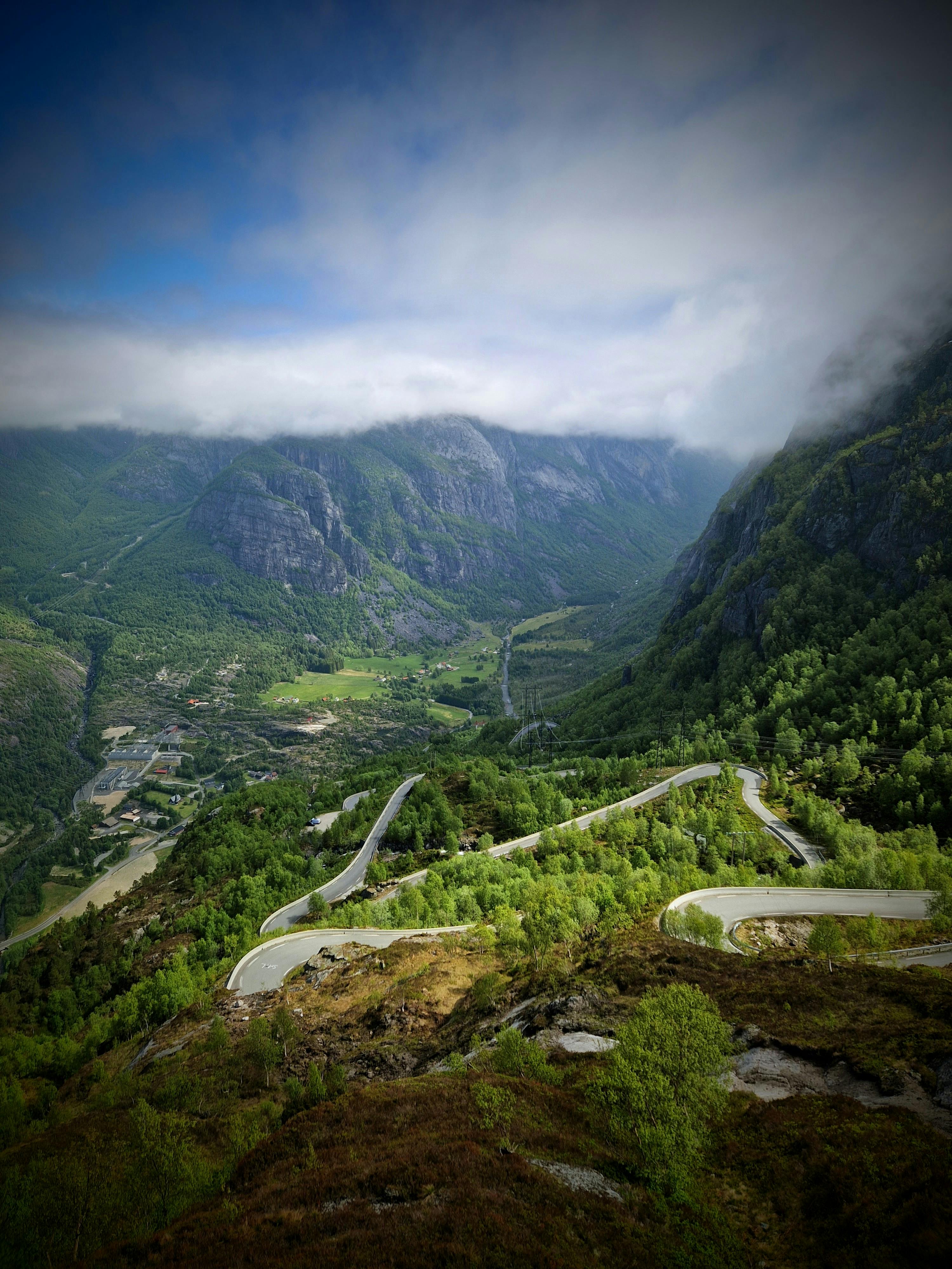
The three stops
1. Eagle Road (Ornevegen) and Ornesvingen viewpoint
The Eagle Road is Rv63 climbing from Geiranger village to the Eidsdal ferry crossing. The road rises 620 meters in 11 hairpin bends over 8 km. The viewpoint at Ornesvingen, roughly halfway up, gives the classic Geirangerfjord photograph: the village below, the fjord stretching northwest toward the Seven Sisters, and the cruise ships docked at the pier.
| Detail | Eagle Road |
|---|---|
| Road | Rv63 (Geiranger to Eidsdal) |
| Elevation gain | 620 meters |
| Hairpin bends | 11 |
| Driving time | 20 to 30 minutes from Geiranger (without stops) |
| Season | Mid-May to late October (weather dependent) |
| Toll | Free |
| Parking at Ornesvingen | Limited. 15 to 20 cars. Fills by 10:00 in July. |
The logistics reality: The Eagle Road is narrow. Two cars can pass, but a campervan and a tour bus cannot. In July and August, the tour buses run the road between 10:00 and 15:00. Drive it before 09:30 or after 16:00 to have the hairpins to yourself. The Ornesvingen viewpoint parking fills fast. If the lot is full, there is no overflow. You drive past and come back later.
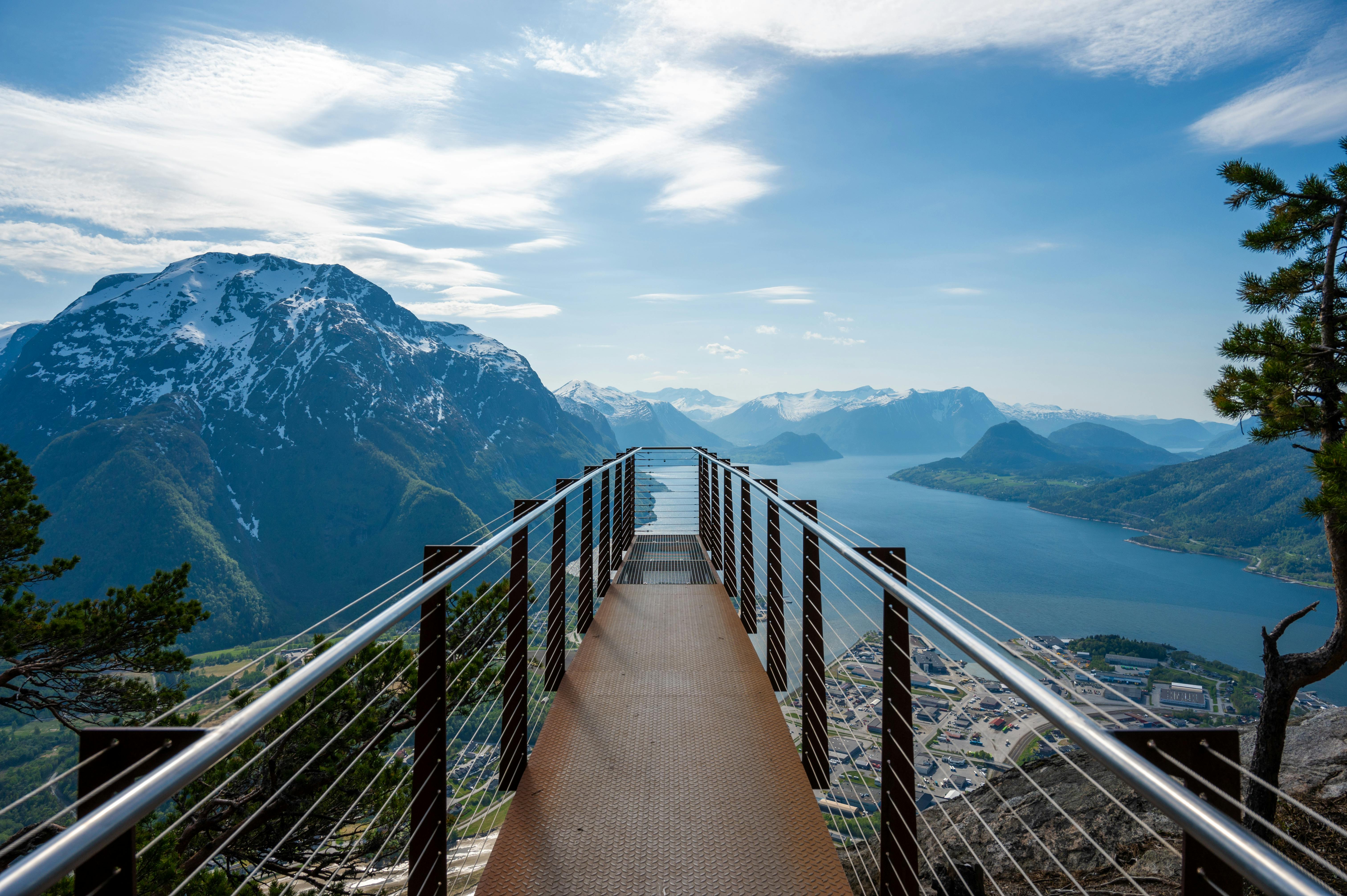
2. Flydalsjuvet viewpoint
Flydalsjuvet sits on the Rv63 south of Geiranger village, about 4 km from the centre. This is the other classic Geirangerfjord photograph: the one taken from above and to the side, showing the fjord, the village, and the green valley floor in a single frame.
Parking is directly at the viewpoint. The walk to the viewing platform takes 2 minutes. A second, lower platform requires a 10-minute walk down a steep path. The lower platform is the better photograph. Bring grippy shoes.
The timing hack: Flydalsjuvet faces north-northwest. Morning light (before 10:00) hits the fjord wall opposite and illuminates the waterfalls. Afternoon light puts Flydalsjuvet in shadow. Photographers: go early.
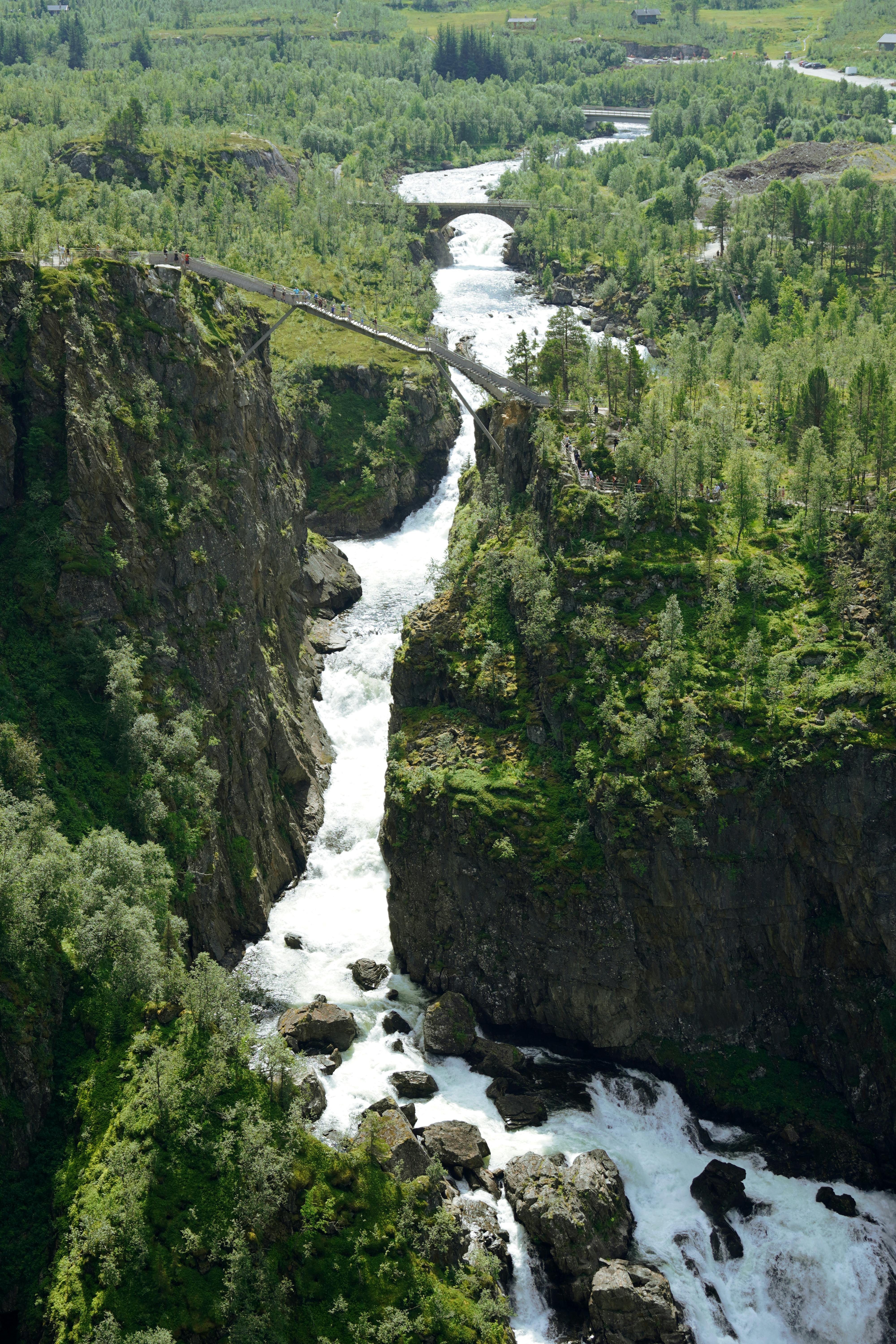
3. Dalsnibba (1,476 meters)
Dalsnibba is the viewpoint that turns Geirangerfjord from a fjord into a map. The toll road (Nibbevegen) branches off Rv63 at Djupvasshytta, 21 km south of Geiranger village, and climbs 5 km to the summit platform at 1,476 meters above sea level.
| Detail | Dalsnibba |
|---|---|
| Elevation | 1,476 meters |
| Toll road (Nibbevegen) | 150 NOK per car (2026) |
| Driving time from Geiranger | 45 minutes (21 km to Djupvasshytta + 5 km toll road) |
| Season | June to October (snow walls line the road into late June) |
| Parking at summit | Large lot, but tour buses dominate 10:00 to 14:00 |
| Facilities | Viewing platform (Geiranger Skywalk). No cafe, no shelter at summit. |
Temperature warning
It can be 20°C at fjord level in Geiranger and freezing at Dalsnibba summit simultaneously. The 1,476-meter elevation difference is real. Bring a windproof jacket and warm layers even in July. Snow walls line the toll road into late June. In October, the road can close overnight without warning due to ice.
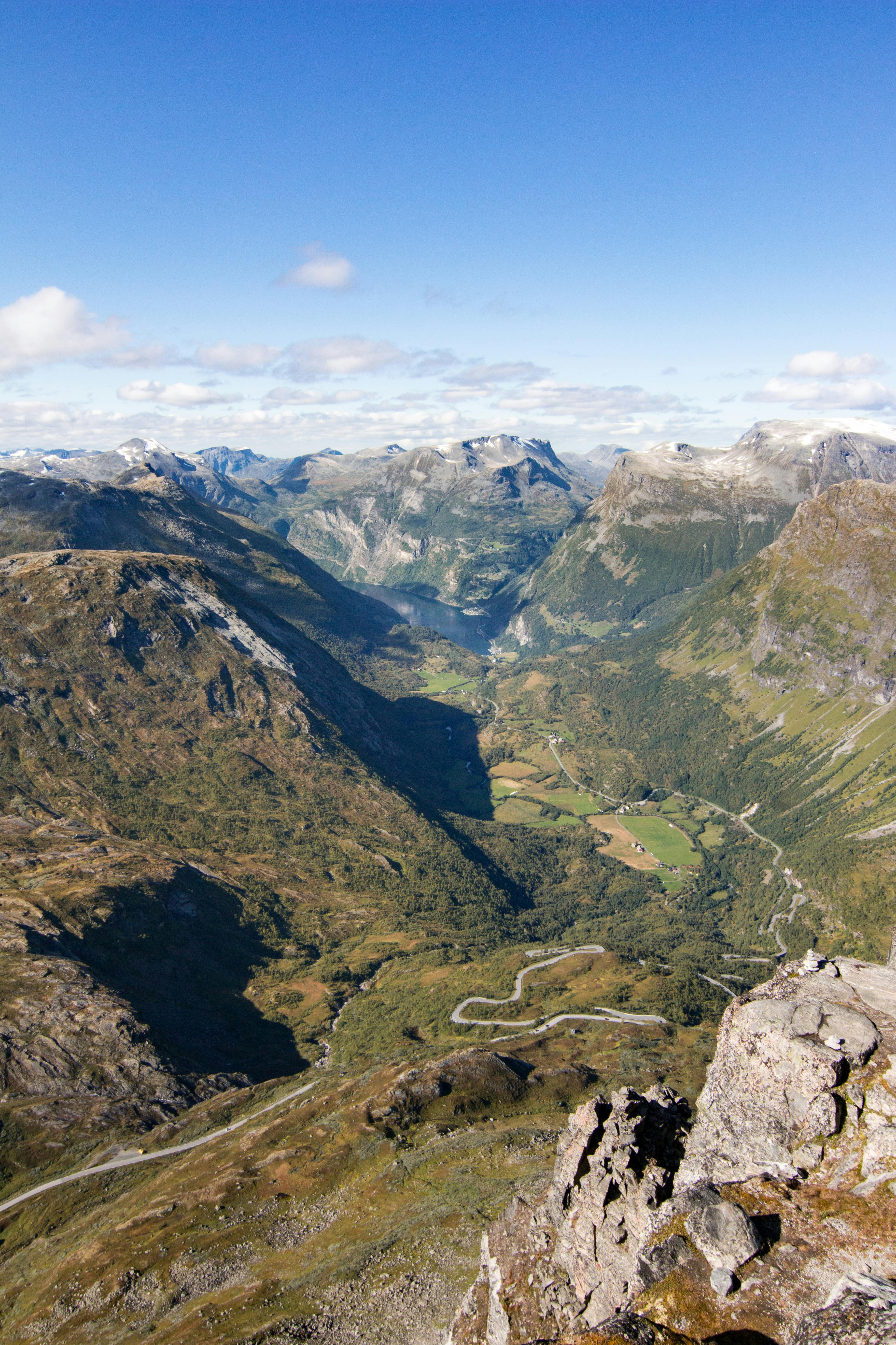
The view: On a clear day, Geirangerfjord is a thin blue line 1,476 meters below. The surrounding peaks of the Sunnmore Alps extend to the horizon. The Geiranger Skywalk platform juts out over the edge. On a cloudy day, you see nothing. The summit sits in cloud roughly 30% of summer days. Check the yr.no webcam at Dalsnibba before driving up.
The driving plan: all three in one day
The optimal sequence depends on when you start and where the tour buses are.
| Time | Stop | Duration |
|---|---|---|
| 07:30 | Flydalsjuvet viewpoint (best morning light, empty parking) | 30 min |
| 08:15 | Drive to Dalsnibba via Rv63 south | 45 min drive |
| 09:00 | Dalsnibba summit (before the tour buses arrive at 10:00) | 30 to 45 min |
| 10:00 | Drive back to Geiranger, then up Eagle Road | 50 min drive |
| 10:50 | Ornesvingen viewpoint on Eagle Road | 20 min |
| 11:30 | Back in Geiranger village for lunch | Done |
Total driving: under 80 km. Total time: 4 hours including all stops. Total cost: 150 NOK (Dalsnibba toll) plus fuel. This is the most cost-effective half-day activity in the Geiranger area.
What works
- Three perspectives on one fjord. Flydalsjuvet gives you the classic side angle. Dalsnibba gives you the aerial view. The Eagle Road gives you the descent into the fjord. Combined, they are a complete visual portrait of Geirangerfjord that no single activity can match.
- The 150 NOK total cost. Compared to 895 NOK for the RIB or 1,550 NOK for the kayak tour, driving the viewpoints is the budget option. You need a car, but if you are already driving in Western Norway, the marginal cost is a toll and a tank of fuel.
- The early morning advantage. The tour buses do not reach the viewpoints before 10:00. If you start at 07:30, you have Flydalsjuvet, Dalsnibba, and the Eagle Road effectively to yourself for 2.5 hours. This is the single best reason to stay overnight in Geiranger rather than visiting as a day trip.
- Snow walls in June. The Dalsnibba toll road opens when the snow is cleared, but walls of snow 3 to 5 meters high line the road into late June. Driving between them is an experience in itself. By late July they are gone.
What does not work
- Cloud at Dalsnibba. The summit sits in cloud roughly 30% of summer days. If you drive up in cloud, you see white in every direction and spend 150 NOK on fog. Check the webcam on yr.no before committing to the toll road. If the summit is in cloud at 08:00, it may clear by 11:00. Or it may not.
- Tour bus congestion. Between 10:00 and 15:00 in July and August, the Eagle Road hairpins become a queue. The Ornesvingen viewpoint parking fills. Dalsnibba summit fills with bus groups. The early morning window is not a suggestion. It is the strategy.
- Campervan limitations. The Eagle Road is passable in a campervan, but passing oncoming tour buses requires reversing into hairpins. The Dalsnibba toll road has no specific vehicle restrictions, but the road is narrow and steep. If you are in a vehicle over 7 meters, consider the scheduled bus service from Geiranger village instead.
- The Akernes factor. The mountain above Geirangerfjord has a crack that geologists monitor continuously. The Akernes rock face is growing by 3.5 inches per year. If it collapses, it will generate a tsunami wave in the fjord. This is not a tourist story. It is a monitored geological risk with an active early warning system and evacuation sirens in Geiranger village. The probability of a collapse during your visit is extremely low, but the monitoring infrastructure is visible and worth understanding.
The seasonal reality
| Month | Eagle Road | Dalsnibba | Notes |
|---|---|---|---|
| May | Open (mid-May) | Closed | Waterfalls at peak flow from snowmelt. Dalsnibba road still under snow. |
| June | Open | Open (early June) | Snow walls on Dalsnibba road. Waterfalls still strong. Best month for the full drive. |
| July to August | Open | Open | Peak crowds. Tour buses dominate 10:00 to 15:00. Waterfalls weaker by late August. |
| September | Open | Open | Crowds thin. Autumn colours on the plateau. First frost at Dalsnibba summit. |
| October | Closing (late Oct) | Closing (early Oct) | Dalsnibba closes first. Eagle Road stays open a few weeks longer. Check vegvesen.no daily. |
After the drive: get on the water
RIB Fjordsafari Geirangerfjord
You have seen the fjord from 1,476 meters above. Now see it from 2 meters above the waterline. The RIB Fjordsafari puts you 15 meters from the Seven Sisters at 35 knots. 50 minutes, 895 NOK, full flotation suit provided.
Read our full review →Ingrid Solheim is the Fjord Logistics Editor at NorgeTravel. She spent eleven years putting tourists into rental cars in Bergen and watching them drive off with itineraries that were never going to work. Her guides are written so that does not happen to you. She can be reached at hei@norgetravel.com.
规划您的挪威行程
使用我们免费的互动行程规划工具,设计您的挪威路线,预订经过验证的环保木屋和交通,并同步当地渡轮时刻表。
Up Next: Keep Exploring
盖朗厄尔峡湾RIB峡湾探险:游轮无法带您领略的风光
RIB峡湾探险带您以35节的速度,在距离七姐妹瀑布15米处飞驰。这里有关于哪些体验很棒,哪些不尽如人意,以及895挪威克朗的价格是否物有所值的所有信息。
在七姐妹瀑布下划皮划艇:在盖朗厄尔峡湾桨行4小时
盖朗厄尔皮划艇之旅让8名桨手置身于七姐妹瀑布之下,与峭壁近在咫尺。4小时,1550挪威克朗,提供干式潜水服。以下是本次体验的具体内容以及适合预订的人群。
Storseterfossen:在盖朗厄尔峡湾上方的30米瀑布后徒步
Fosserasa步道从一个17世纪的夏季农场攀升257米,到达Storseterfossen瀑布后方的一处岩石凹室。它是挪威仅有的六条国家徒步路径之一,也是唯一一条可以从瀑布后面走过的路径。