Skibotn’s rain shadow: chasing the Northern Lights in one of Norway’s driest villages
Why the dry air east of the Lyngen Alps gives aurora chasers better odds than the coast. The weather science, where to stand and the winter drive from Tromsø.
Skibotn gets 300 to 450 mm of precipitation a year. Tromsø gets more than 1,000. When the coast clouds over, this village on the Lyngenfjord is where aurora chasers drive. Here’s why it stays dry, where to stand and how to handle the E8 in winter.
Aurora hunting in Troms is a cloud game. A strong geomagnetic storm overhead means nothing if you're standing under a lid of coastal cloud. So when the sky over Tromsø closes, aurora chasers drive inland, and many of them stop in Skibotn: a village of 539 people on the southeastern shore of the Lyngenfjord, where the E8 turns off toward Finland.
Skibotn is one of the driest places in mainland Norway. Yr, the Norwegian Meteorological Institute's forecast service, lists it among the country's six driest weather stations at 300 mm of precipitation a year. Newer climate tables put it near 450 mm. Tromsø gets more than 1,000 mm. Dry air doesn't guarantee a clear sky, but it shifts the odds your way.
Why Skibotn stays dry
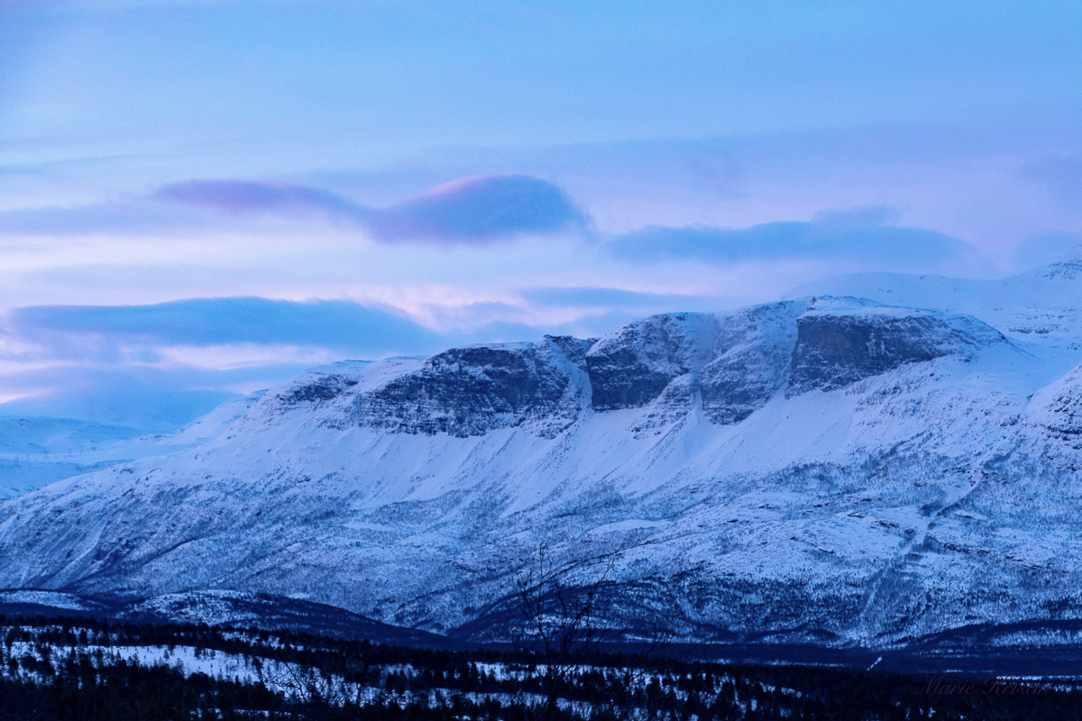
Weather in Troms rolls in off the Norwegian Sea. Before it reaches Skibotn it has to cross the islands around Tromsø and the Lyngen Alps, which rise to more than 1,800 meters. The air climbs, cools and drops its snow on the western slopes. What sinks down the far side into the Skibotn valley carries far less moisture. That's the rain shadow.
The Meteorological Institute adds three local reasons: northerly winds bring little precipitation to Troms, a large island shelters the mouth of the Lyngenfjord, and the Skibotn weather station sits a little way up a side valley. The rain shadow is real, but it isn't a wall. When cloud covers the whole region, Skibotn clouds over too.
Scientists bet on the same sky. UiT The Arctic University of Norway runs the Skibotn Observatory here, with optical instruments that record the aurora, including a spectrograph installed in 2023. The core site of EISCAT_3D, a European research radar built to study the upper atmosphere, stands 2 km away. Both are working research facilities, not viewpoints. Don't park at their gates.
Where to stand
- Skibotndalen along the E8: Drive the E8 up the valley toward the Finnish border. The village lights drop behind you within a few kilometers. Stop only in plowed lay-bys and parking areas, never on the road shoulder. The E8 is the main road between Tromsø and Finland, and trucks run it through the night.
- The fjord shore: The shoreline around the village faces west across the fjord to the Lyngen Alps. On a calm night the aurora reflects in the water, with the peaks as a black skyline.
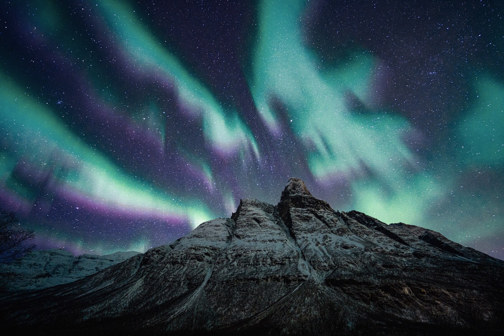
- Signaldalen: Signaldalen cuts south from Storfjorden, the inner arm of the Lyngenfjord, and you pass it on the E6 between Nordkjosbotn and Skibotn. The valley leads to Otertind (1,356 m), a double-pyramid peak photographers use as an aurora foreground.
Before you leave Tromsø
- Check the cloud, not just the aurora: Compare the hourly cloud-cover forecast for Tromsø and Skibotn on yr.no. If the coast shows cloud and Skibotn shows a gap, go.
- Check the activity: At this latitude, a Kp index of 3 under a clear sky is enough for a visible display. That's the combination you're hunting.
- Check the road: Call 175 or open Statens vegvesen's traffic map for closures and convoy driving before you set off.
The cold and the road
The clear sky you came for strips heat from the ground fast, and cold air drains into Skibotndalen and pools there. On a clear January night the valley runs far colder than Tromsø's harbour, and -20°C is not unusual. Dress for standing still for two hours: wool base layer, insulated jacket, winter boots rated well below the forecast, mittens over liner gloves. Leave the cotton at home. It holds moisture against your skin and speeds up hypothermia.
- Reindeer: Skibotndalen is reindeer grazing land, and reindeer use the plowed E8 as an easy path at night. Drive at a speed that lets you stop inside your headlight beam.
- Fuel: Fill the tank in Tromsø. You'll run the engine for heat while you wait, and that burns fuel faster than you expect.
- Tyres: From 16 October to 30 April, Norwegian law requires at least 3 mm of tread on winter tyres in Troms. Rental cars come fitted in season. Check before you leave the lot.
Winter road and safety logistics
| Detail | Information |
|---|---|
| Drive from Tromsø | 117 km on the E8, which shares the road with the E6 from Nordkjosbotn to Skibotn. 1 hour 40 minutes to 2 hours on dry roads; 2.5 hours or more on snow |
| Main hazards | Black ice, drifting snow, reindeer on the road, heavy trucks on the E8 |
| Tyre rule (Troms) | At least 3 mm tread, 16 October to 30 April |
| Road status | 175 (Statens vegvesen traffic information) |
| Emergency | 112 police and rescue, 113 ambulance |
When Skibotn clouds over
Keep driving. The E8 climbs Skibotndalen to the Finnish border and reaches Kilpisjärvi, 50 km from Skibotn by road. Inland Finnish Lapland often holds a clear sky when the coast is socked in. Carry your passport or national ID card. Norway and Finland are both in Schengen, but Norway sits outside the EU customs union.
If the forecast shows cloud everywhere, stay in Tromsø and sleep. Book three nights, not one. The aurora is a weather phenomenon, and some of those nights will be cloudy.
The market village
Skibotn has three names: Ivgobahta in Sami, Markkina in Kven and Skibotn in Norwegian. The Kven name means the market. Written sources mention a market here as early as 1571. By the 1800s it was the largest trading market in North Troms, held twice a year: the November market for reindeer-herding Sami and the late-January market for Kven traders, with sea Sami and Norwegians trading alongside. Nord-Troms Museum looks after the old market site today. Come back in daylight and walk it.
Bjørn Haugen is the Arctic Field Editor at NorgeTravel. He has guided in Nord-Norge and Svalbard for over twenty years and volunteered with Arctic search and rescue. He writes about the Arctic so underprepared travellers do not become statistics. He can be reached at hei@norgetravel.com.
Sources: Yr/Norwegian Meteorological Institute precipitation data; Statens vegvesen tyre requirements; UiT and EISCAT_3D project pages; Nord-Troms Museum; Storfjord kommune. Checked October 2026.
Plan your Norway itinerary
Use our free, interactive trip planner to map out your route through Norway, book verified eco-friendly cabins and transport, and sync with local ferry timetables.
Up Next: Keep Exploring
The Mountain Code: 9 rules every hiker in Norge must follow
Every year, Norwegian rescue teams retrieve hikers who treated the Fjellvettreglene as optional. The Mountain Code is nine rules built from decades of mountain rescue operations. Learn each one before you lace up your boots.
Winter driving in Norge: tires, chains, and the roads that close
Norge closes 30+ mountain passes every winter and fines drivers 8,500 NOK for wrong tires. This guide covers the exact tire laws, chain requirements, seasonal road closures, and which rental car category keeps you moving from October through April.
What to pack for Arctic Norge, month by month
Arctic Norge is not one climate. It is eleven distinct packing problems spaced across the year. The temperature range from January in Longyearbyen to July in Tromsø is over 40 degrees Celsius. A field-tested, month-by-month packing guide from 25 years of Arctic guiding.