普雷斯特峰2026:奥兰峡湾上方1,478米山顶,Bjørgavegen小径起点在施泰格斯坦观景台之后
这条小径从奥兰上方8公里处的Bjørgavegen开始,攀登500米到达海拔1,478米的普雷斯特峰顶,可俯瞰奥兰峡湾。单程2.1公里,DNT红色路线,开放时间为六月中旬至十月初。
普雷斯特小径从Bjørgavegen上的一个停车湾开始攀登,直至海拔1,478米的普雷斯特峰顶,途中可将海拔1,363米的Røyrgrind标志作为中间目标。单程2.1公里,海拔爬升500米,DNT红色路线,往返2至3小时。小径陡峭、暴露,但能欣赏到奥兰峡湾的垂直视角美景。
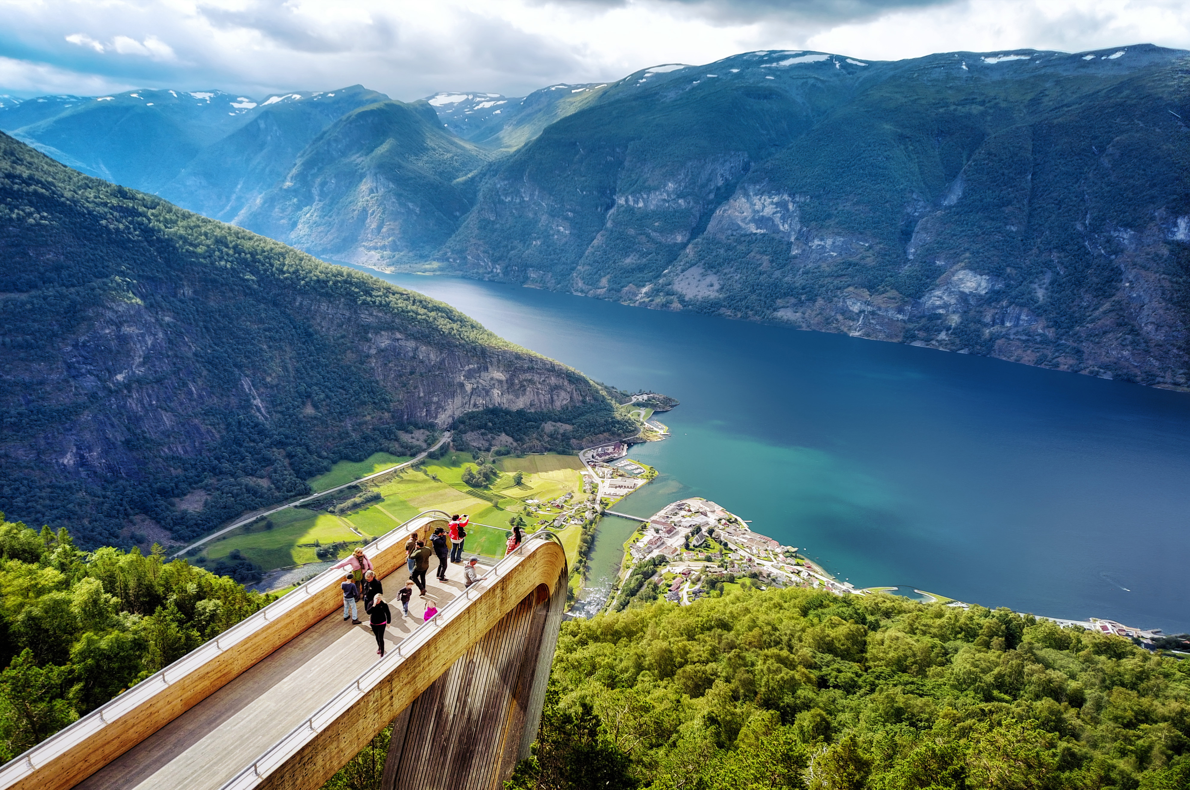
The Prest trail is not the hike most visitors find when they search for "Flåm hiking." It does not leave from the railway terminus, the campsite, or the ferry pier. It leaves from a small parking bay on the Bjørgavegen, 8 km above Aurlandsvangen, past the Stegastein platform, on the mountain road that climbs the Aurlandsfjellet scenic route.
Most hikers who start this trail drove up from Aurland to photograph Stegastein first. Only a small fraction keep driving past the platform, look for the unmarked lay-by, and climb the 500 metres to the ridge above. That is why this trail stays quiet even in late July.
The trailhead
The Prest trailhead is a small unmarked parking bay on the Bjørgavegen (Fv243), approximately 8 km from Aurlandsvangen and past the Stegastein platform. From Stegastein, continue up the scenic route for roughly 2 km. The parking bay is on the right, with space for four or five cars. A faint path leaves the road and climbs directly up the slope.
There is no signposting at the trailhead. The Norwegian name of the trail is Prest, the summit is sometimes marked on maps as Prestholet. Download the ut.no app route offline before you leave mobile coverage in Aurland. The path is cairned once you are on the slope, but finding the start requires the app or local knowledge.
The route
The trail climbs steadily from the road at approximately 980 m to the Røyrgrind beacon at 1,363 m. This first section takes 1 to 1.5 hours and covers about 1.4 km of walking. The beacon is a stone cairn visible from some distance and is the natural turnaround point for hikers who do not want the full summit. The view from Røyrgrind is already substantial.
From Røyrgrind, the route continues across the high ridge to the Prest summit at 1,478 m. This section is approximately 700 m further and adds 115 m of elevation. It takes 30 to 45 minutes each way. The ridge is exposed. In strong wind or poor visibility, the intermediate beacon at Røyrgrind is the correct turnaround.
Total route: 2.1 km each way, 500 m elevation gain, 2 to 3 hours round trip including time at the summit. DNT grade: Red. The gradient is sustained (500 m in 2.1 km is roughly 24%), the terrain is rocky, and the final ridge is exposed without shelter.
The view
From the Prest summit, Aurlandsfjord sits almost vertically below you. The drop from 1,478 m to sea level is one of the steeper sightlines on any marked trail in the Sognefjord system. Aurland village is visible at the head of the fjord to the south. Flåm sits further south at the end of the Flåm arm. The Stegastein platform is visible below you to the east.
Nærøyfjord is not visible from Prest. The Nærøyfjord arm runs west from the fjord junction at Beitelen, behind the ridge that Prest sits on. Trail guides that claim a Nærøyfjord view from this summit are wrong. For Nærøyfjord from height, the Stalheim–Nåli route above Stalheim on the opposite side of the fjord network is the correct trail.
Season and conditions
The Bjørgavegen is a seasonal road. The scenic route opens in late May and closes in mid-October, weather dependent. Check vegvesen.no for current status before driving up. The Prest trail itself is snow-free from mid-June to early October in a typical year. Outside that window, the upper ridge holds snow and ice.
Weather at 1,478 m is not the weather in Aurland. Temperature at the summit runs 8 to 10°C cooler than the fjord floor. Wind on the exposed ridge is consistently stronger than forecast at the valley. Bring a windproof shell, a warm mid-layer, hiking boots with ankle support, and hands-free gloves for the final ridge in early or late season. Check yr.no for the Aurland forecast and add one category of severity for the summit.
Practical information
- Distance: 2.1 km each way, 4.2 km round trip
- Elevation gain: 500 m
- Summit elevation: Prest 1,478 m. Intermediate Røyrgrind beacon 1,363 m.
- Time: 2 to 3 hours round trip including summit time
- DNT grade: Red (demanding)
- Trailhead: Unmarked lay-by on the Bjørgavegen (Fv243), approximately 8 km from Aurlandsvangen, past Stegastein
- Season: Mid-June to early October. Bjørgavegen opens late May, closes mid-October.
- Navigation: Download ut.no offline. No signposting at trailhead.
- Facilities: None. Nearest toilets at Stegastein platform, 2 km back down the road.
- Emergency: 112 police and rescue, 113 medical
The Prest trail is the hike for travellers who already know they want effort over access. It is the answer to the question "I have seen Stegastein, what is the next level up?" The 500-metre climb and the ridge exposure mean this is not a casual afternoon. The view from the summit is the reason it is worth the drive past Stegastein and the walk from the lay-by.
Ingrid Solheim is the Fjord Logistics Editor at NorgeTravel. She spent eleven years putting tourists into rental cars in Bergen and watching them drive off with itineraries that were never going to work. Her guides are written so that does not happen to you. She can be reached at hei@norgetravel.com.
规划您的挪威行程
使用我们免费的互动行程规划工具,设计您的挪威路线,预订经过验证的环保木屋和交通,并同步当地渡轮时刻表。
Up Next: Keep Exploring
盖朗厄尔峡湾RIB峡湾探险:游轮无法带您领略的风光
RIB峡湾探险带您以35节的速度,在距离七姐妹瀑布15米处飞驰。这里有关于哪些体验很棒,哪些不尽如人意,以及895挪威克朗的价格是否物有所值的所有信息。
在七姐妹瀑布下划皮划艇:在盖朗厄尔峡湾桨行4小时
盖朗厄尔皮划艇之旅让8名桨手置身于七姐妹瀑布之下,与峭壁近在咫尺。4小时,1550挪威克朗,提供干式潜水服。以下是本次体验的具体内容以及适合预订的人群。
自驾盖朗厄尔:一天之内游览老鹰之路、飞来峡谷观景台和达尔斯尼巴
老鹰之路共有11个发夹弯,海拔攀升620米。达尔斯尼巴观景台海拔1476米,盖朗厄尔峡湾在脚下犹如一条纤细的蓝色丝带。本攻略将教您如何一天内自驾游览这两处景点,轻松避开旅游大巴,不再为停车位烦恼。